MyTopo
Porter New Mexico US Topo Map
Couldn't load pickup availability
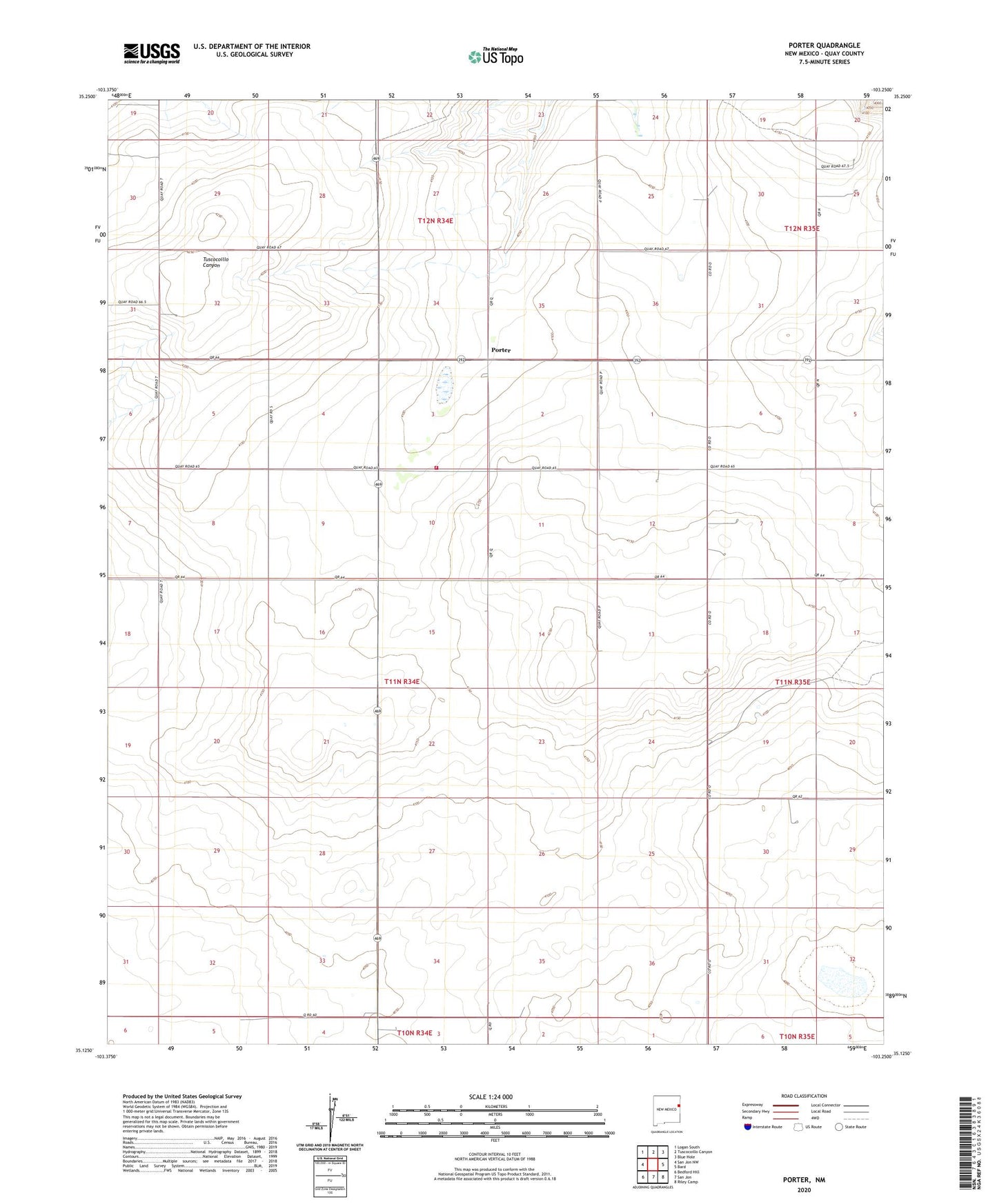
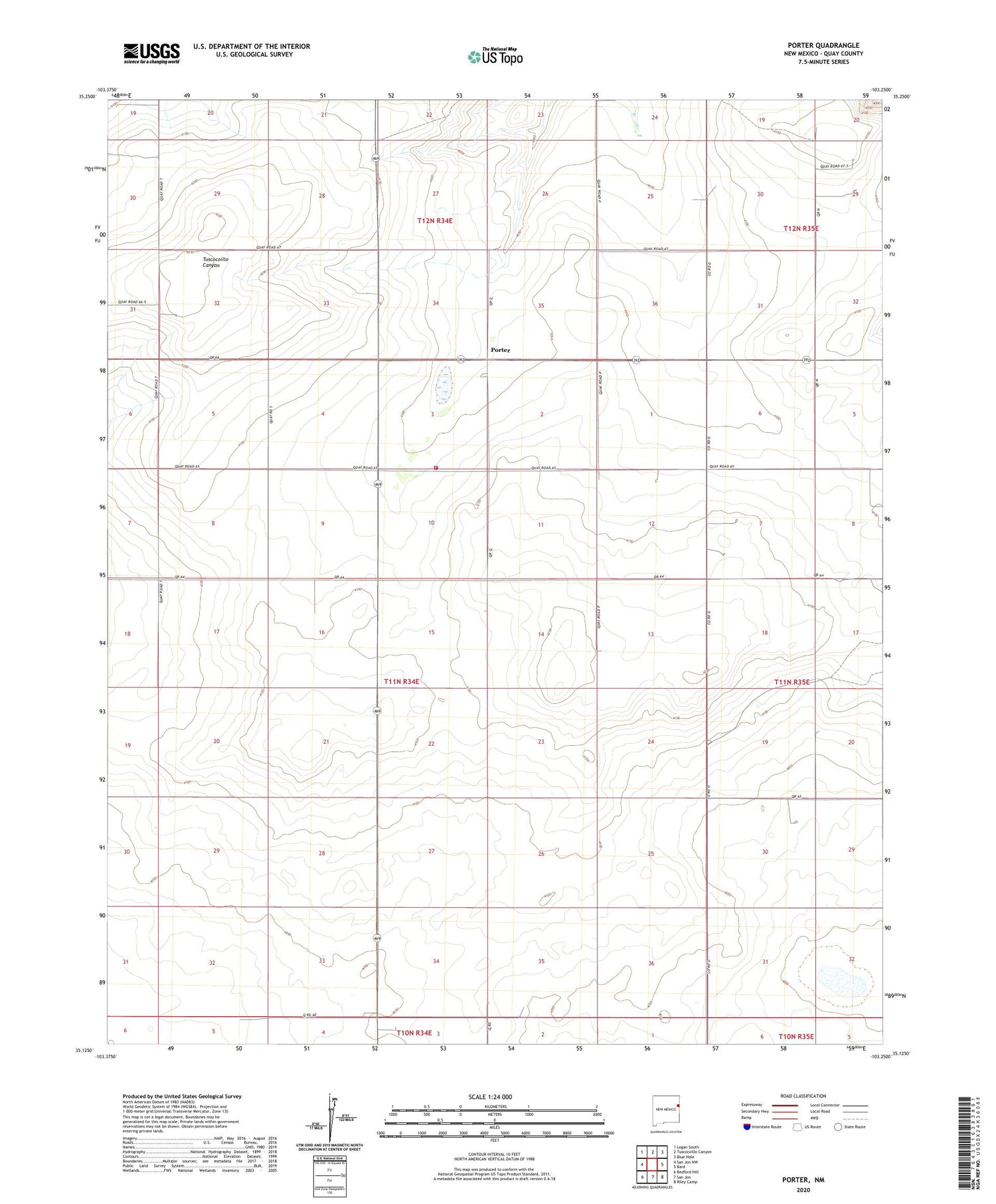
2020 topographic map quadrangle Porter in the state of New Mexico. Scale: 1:24000. Based on the newly updated USGS 7.5' US Topo map series, this map is in the following counties: Quay. The map contains contour data, water features, and other items you are used to seeing on USGS maps, but also has updated roads and other features. This is the next generation of topographic maps. Printed on high-quality waterproof paper with UV fade-resistant inks.
Quads adjacent to this one:
West: San Jon NW
Northwest: Logan South
North: Tuscocoillo Canyon
Northeast: Blue Hole
East: Bard
Southeast: Riley Camp
South: San Jon
Southwest: Bedford Hill
Contains the following named places: 05206 Water Well, 05398 Water Well, 05399 Water Well, 05400 Water Well, 05401 Water Well, 05402 Water Well, 05403 Water Well, 05404 Water Well, 05405 Water Well, 05406 Water Well, 05418 Water Well, 05419 Water Well, 05535 Water Well, 05536 Water Well, 05537 Water Well, 05538 Water Well, 05539 Water Well, 05540 Water Well, 05541 Water Well, 05548 Water Well, 05549 Water Well, 05557 Water Well, 05558 Water Well, 05560 Water Well, 05570 Water Well, 88434, Anniston Post Office, Gibson, Porter, Porter Fire District, Porter Post Office, Porter Weather Station, San Jon Division, Wallin