MyTopo
Pueblo Alto Trading Post New Mexico US Topo Map
Couldn't load pickup availability
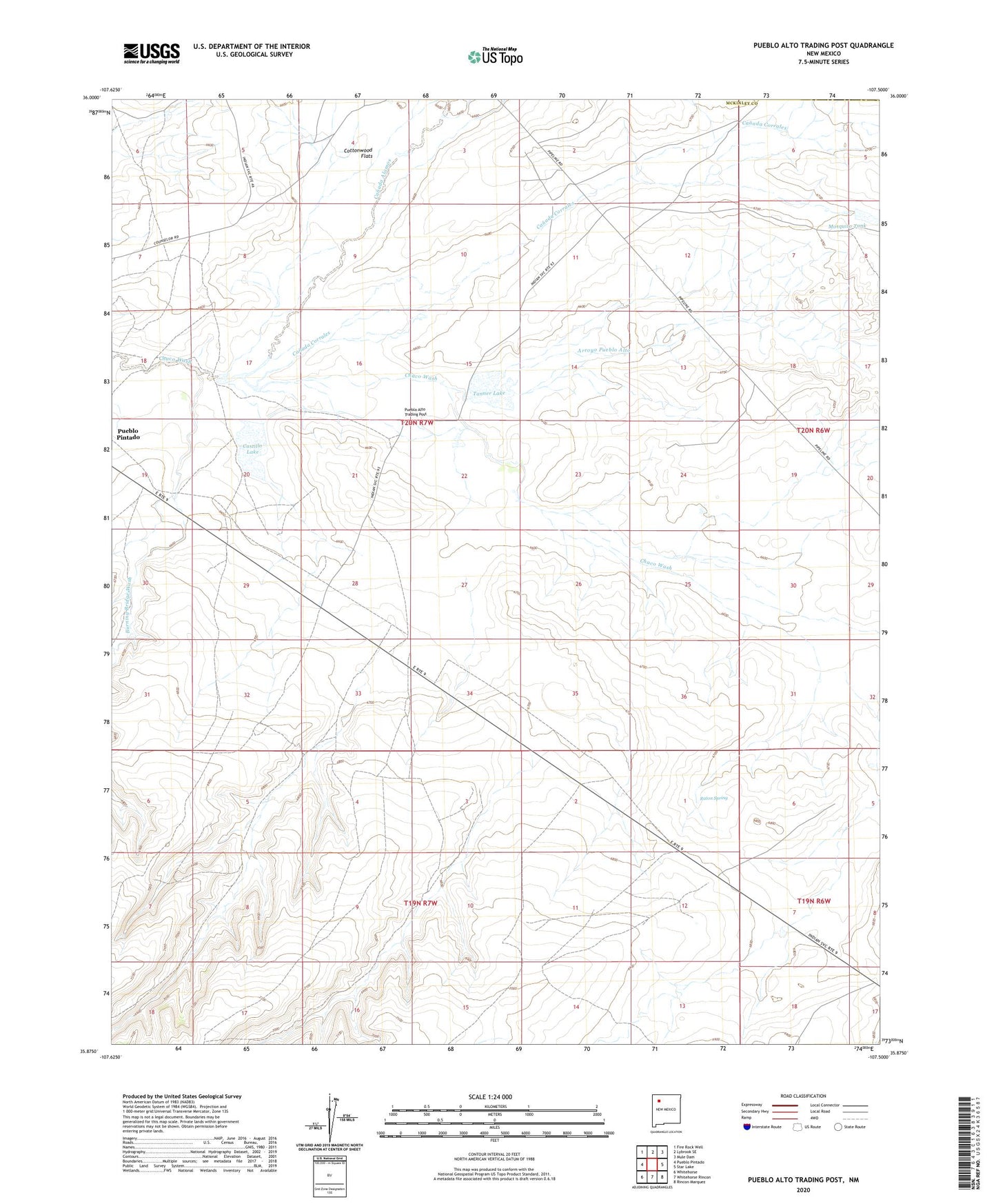
2023 topographic map quadrangle Pueblo Alto Trading Post in the state of New Mexico. Scale: 1:24000. Based on the newly updated USGS 7.5' US Topo map series, this map is in the following counties: McKinley, Sandoval. The map contains contour data, water features, and other items you are used to seeing on USGS maps, but also has updated roads and other features. This is the next generation of topographic maps. Printed on high-quality waterproof paper with UV fade-resistant inks.
Quads adjacent to this one:
West: Pueblo Pintado
Northwest: Fire Rock Well
North: Lybrook SE
Northeast: Mule Dam
East: Star Lake
Southeast: Rincon Marquez
South: Whitehorse Rincon
Southwest: Whitehorse
This map covers the same area as the classic USGS quad with code o35107h5.
Contains the following named places: 19R-300 Water Well, Arroyo Pueblo Alto, Burning Bridge Wash, Canada Alamos, Canada Corrales, Castillo Lake, CCR 24 Water Well, Cottonwood Flats, Mosquito Dam, Mosquito Tank, Pot Point, Pueblo Alto Trading Post, Pueblo Pintado Census Designated Place, Pueblo Pintado Chapter, Raton Spring, Tanner Lake