MyTopo
Mule Dam New Mexico US Topo Map
Couldn't load pickup availability
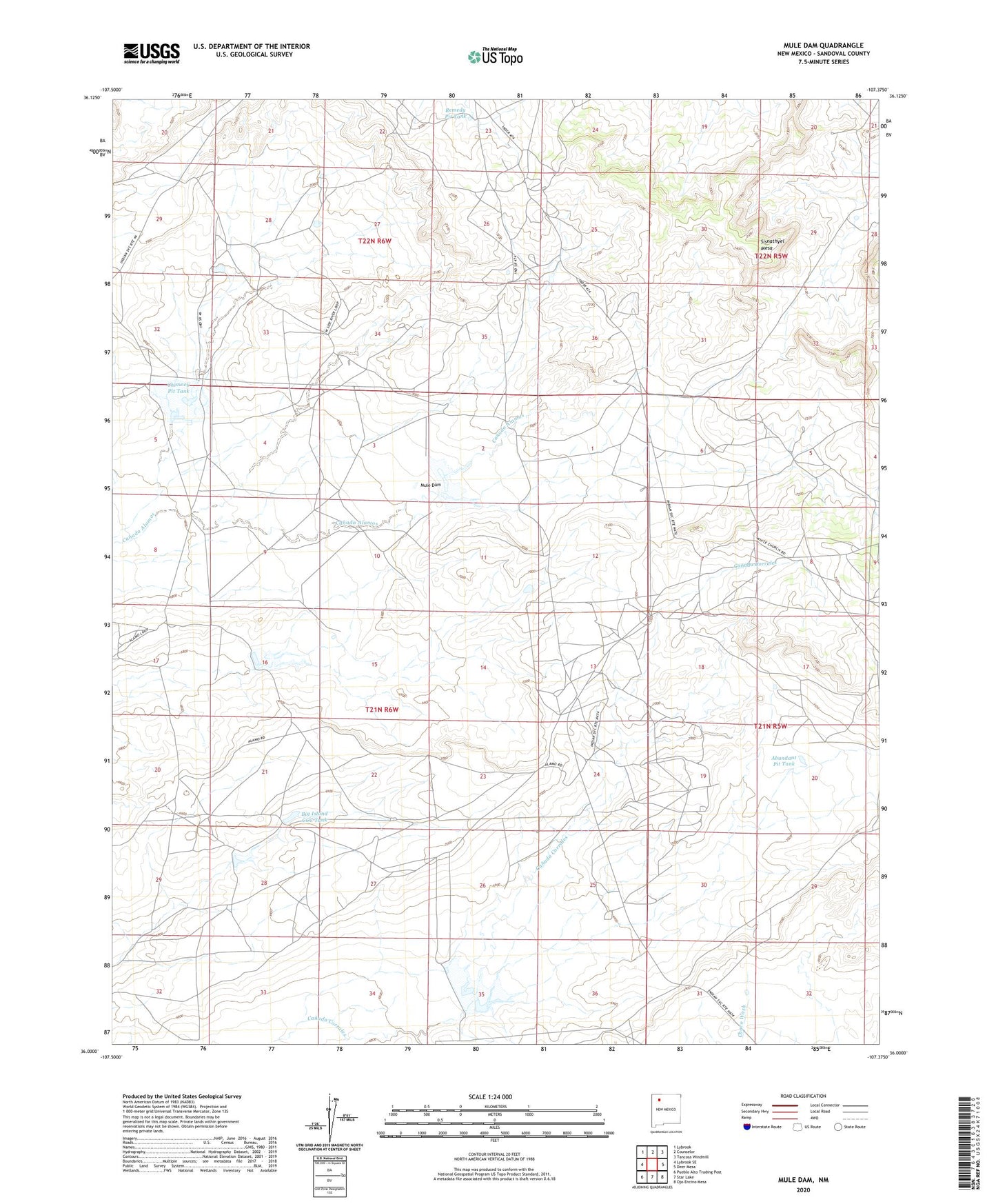
2023 topographic map quadrangle Mule Dam in the state of New Mexico. Scale: 1:24000. Based on the newly updated USGS 7.5' US Topo map series, this map is in the following counties: Sandoval. The map contains contour data, water features, and other items you are used to seeing on USGS maps, but also has updated roads and other features. This is the next generation of topographic maps. Printed on high-quality waterproof paper with UV fade-resistant inks.
Quads adjacent to this one:
West: Lybrook SE
Northwest: Lybrook
North: Counselor
Northeast: Tancosa Windmill
East: Deer Mesa
Southeast: Ojo Encino Mesa
South: Star Lake
Southwest: Pueblo Alto Trading Post
This map covers the same area as the classic USGS quad with code o36107a4.
Contains the following named places: Abundant Pit Tank, Big Island CCC Tank, Big Island Dam, Canada Corrales Dam, Canyonada Corralis Dam, Center Dam, Center Detention Dam, Chimney Dam, Chimney Detention Dam, Chimney Pit Tank, Counselor Chapter, Dennison Well, Herrera Well, Mule Dam, Mule Detention Dam, Remedy Pit Tank, Sisnathyel Mesa, White Point Well