MyTopo
Rocky Point New Mexico US Topo Map
Couldn't load pickup availability
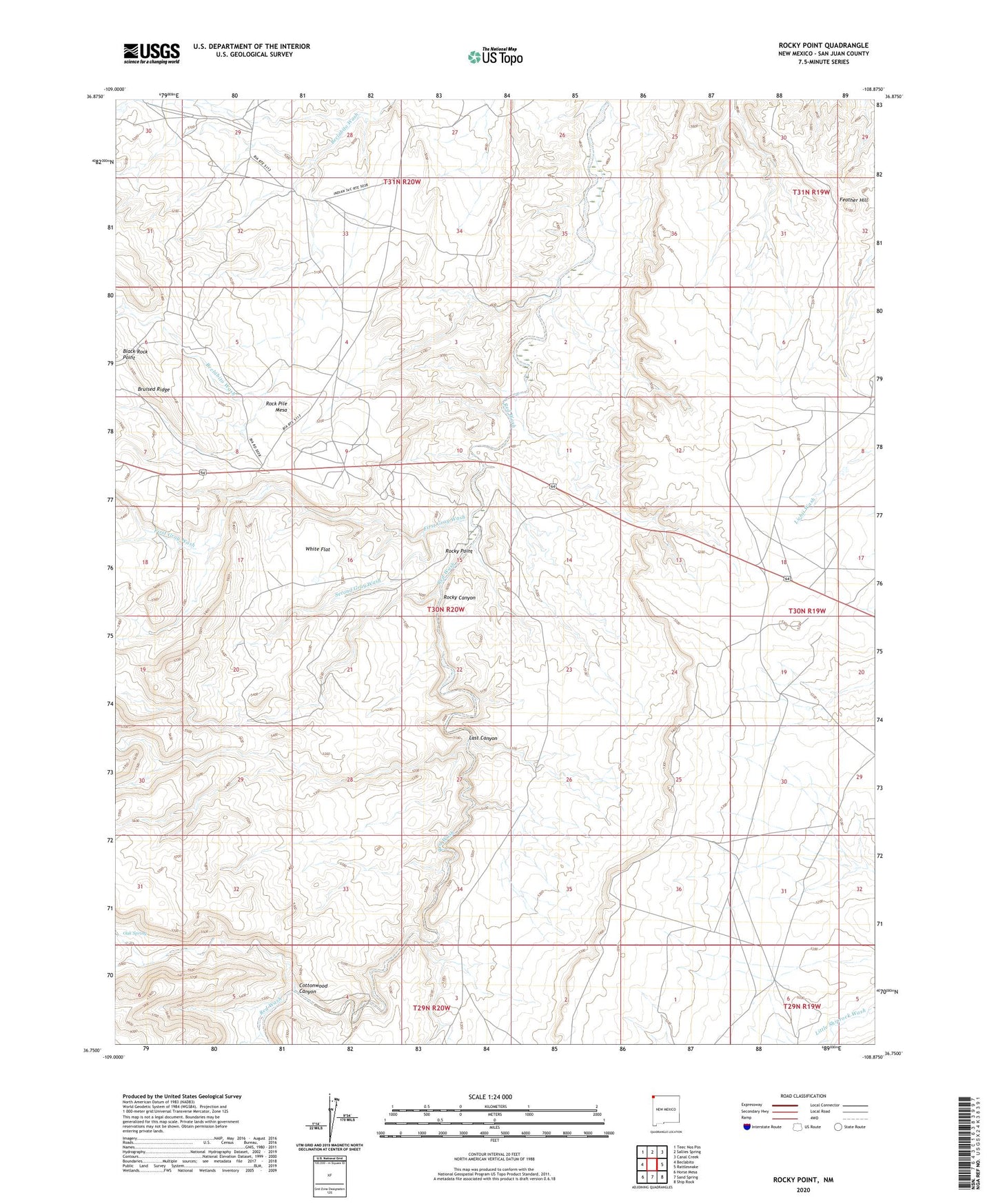
2020 topographic map quadrangle Rocky Point in the state of New Mexico. Scale: 1:24000. Based on the newly updated USGS 7.5' US Topo map series, this map is in the following counties: San Juan. The map contains contour data, water features, and other items you are used to seeing on USGS maps, but also has updated roads and other features. This is the next generation of topographic maps. Printed on high-quality waterproof paper with UV fade-resistant inks.
Quads adjacent to this one:
West: Beclabito
Northwest: Teec Nos Pos
North: Sallies Spring
Northeast: Canal Creek
East: Rattlesnake
Southeast: Ship Rock
South: Sand Spring
Southwest: Horse Mesa
Contains the following named places: 12P-355 Water Well, 12R-148 Water Well, 87420, Beclabito Chapter, Black Rock Point, Black Water Well, Bruised Ridge, Cottonwood Canyon, Feather Hill, First Gray Wash, Last Canyon, Oak Spring, Rock Pile Mesa, Rocky Canyon, Rocky Point, Second Gray Wash, White Flat