MyTopo
Sallies Spring New Mexico US Topo Map
Couldn't load pickup availability
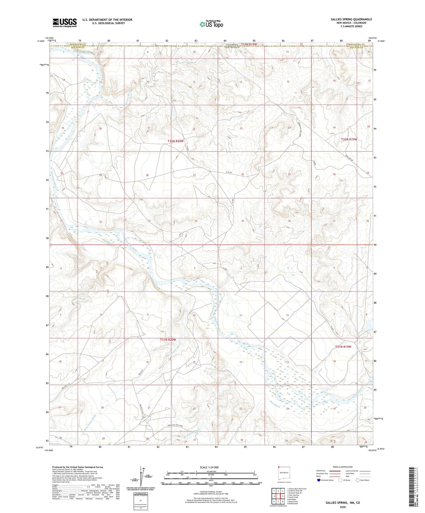
2023 topographic map quadrangle Sallies Spring in the state of New Mexico. Scale: 1:24000. Based on the newly updated USGS 7.5' US Topo map series, this map is in the following counties: San Juan, Montezuma. The map contains contour data, water features, and other items you are used to seeing on USGS maps, but also has updated roads and other features. This is the next generation of topographic maps. Printed on high-quality waterproof paper with UV fade-resistant inks.
Quads adjacent to this one:
West: Teec Nos Pos
Northwest: Yellow Rock Point East
North: Sentinel Peak SW
Northeast: Sentinel Peak SE
East: Canal Creek
Southeast: Rattlesnake
South: Rocky Point
Southwest: Beclabito
This map covers the same area as the classic USGS quad with code o36108h8.
Contains the following named places: 12T-517 Water Well, Area Silt Dam, Beclabito Wash, Mancos River, Red Wash, Salt Wash, Shoe Game Wash