MyTopo
Teec Nos Pos Arizona US Topo Map
Couldn't load pickup availability
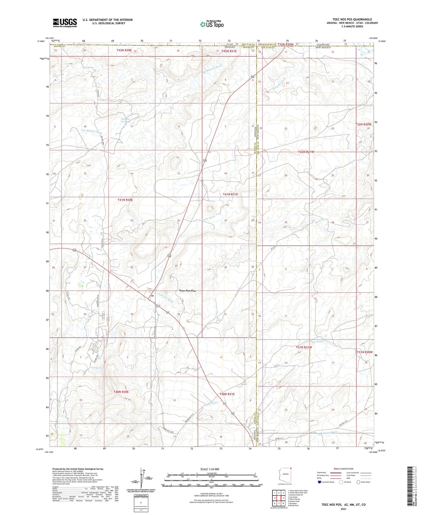
2021 topographic map quadrangle Teec Nos Pos in the states of Arizona, New Mexico. Scale: 1:24000. Based on the newly updated USGS 7.5' US Topo map series, this map is in the following counties: Apache, San Juan, Montezuma. The map contains contour data, water features, and other items you are used to seeing on USGS maps, but also has updated roads and other features. This is the next generation of topographic maps. Printed on high-quality waterproof paper with UV fade-resistant inks.
Quads adjacent to this one:
West: Cow Butte
Northwest: Yellow Rock Point West
North: Yellow Rock Point East
Northeast: Sentinel Peak SW
East: Sallies Spring
Southeast: Rocky Point
South: Beclabito
Southwest: Pastora Peak
Contains the following named places: 12K-335 Water Well, 12T-340 Water Well, Carrizo Mission School, Four Corners, Four Corners Monument, Goat Spring, Navajo Lutheran Missions, Shorthair Well, Teec Nos Pos, Teec Nos Pos Ambulance Service, Teec Nos Pos Census Designated Place, Teec Nos Pos Chapter House, Teec Nos Pos Landing Strip, Teec Nos Pos Post Office, Teec Nos Pos Wash, Tiis Nazbas Community School, Tohache Recreation Area