MyTopo
Sagebrush Valley West New Mexico US Topo Map
Couldn't load pickup availability
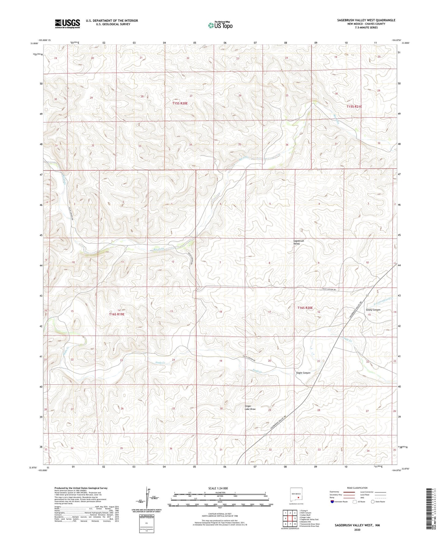
2020 topographic map quadrangle Sagebrush Valley West in the state of New Mexico. Scale: 1:24000. Based on the newly updated USGS 7.5' US Topo map series, this map is in the following counties: Chaves. The map contains contour data, water features, and other items you are used to seeing on USGS maps, but also has updated roads and other features. This is the next generation of topographic maps. Printed on high-quality waterproof paper with UV fade-resistant inks.
Quads adjacent to this one:
West: Singer Lake
Northwest: Flying H
North: Dark Canyon
Northeast: Indian Bluff
East: Sagebrush Valley East
Southeast: Sixteenmile Draw East
South: Sixteenmile Draw West
Southwest: Meadow Hill
Contains the following named places: 06333 Water Well, 10649 Water Well, Buck Windmill, Cottonwood Windmill, Eagle Canyon, Eagle Windmill, Metal Tank Well, North Windmill, Singer Lake Draw, Southwest Chaves Division, Tecolote Windmill, Treat Ranch, Yellow Windmill