MyTopo
Sardine Mountain New Mexico US Topo Map
Couldn't load pickup availability
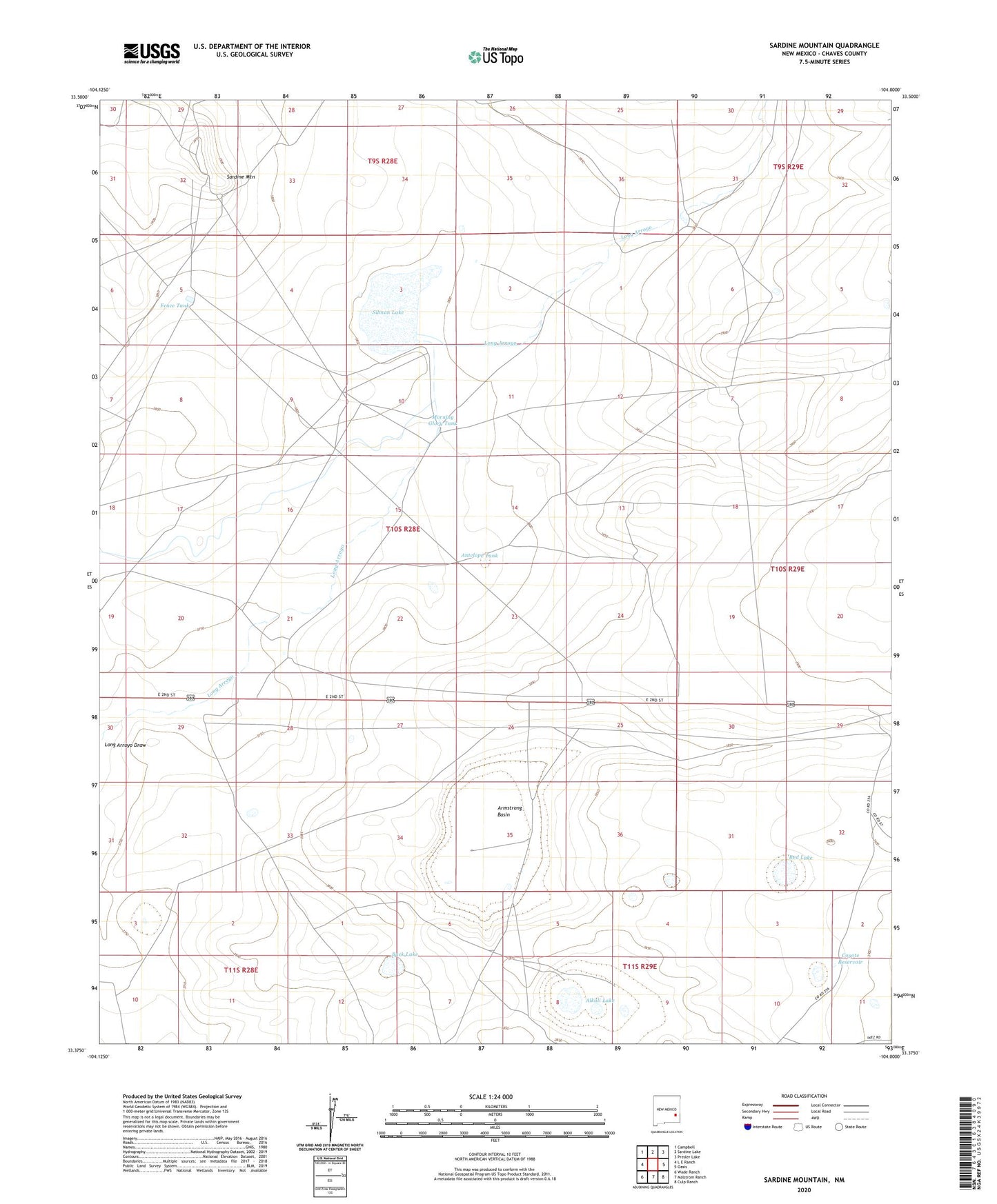
2023 topographic map quadrangle Sardine Mountain in the state of New Mexico. Scale: 1:24000. Based on the newly updated USGS 7.5' US Topo map series, this map is in the following counties: Chaves. The map contains contour data, water features, and other items you are used to seeing on USGS maps, but also has updated roads and other features. This is the next generation of topographic maps. Printed on high-quality waterproof paper with UV fade-resistant inks.
Quads adjacent to this one:
West: L E Ranch
Northwest: Campbell
North: Sardine Lake
Northeast: Presler Lake
East: Oasis
Southeast: Culp Ranch
South: Malstrom Ranch
Southwest: Wade Ranch
This map covers the same area as the classic USGS quad with code o33104d1.
Contains the following named places: Alkali Lake, Amison Well, Antelope Tank, Armstrong Basin, Armstrong Well, Buck Lake, Coyote Reservoir, Fence Tank, House Well, Jackson Well, Morning Glory Tank, Morrisey Well, New Well, Race Track Well, Red Lake, Red Tip Well, Sardine Mountain, Sardine Tank, Silman Lake