MyTopo
Sawmill Mesa New Mexico US Topo Map
Couldn't load pickup availability
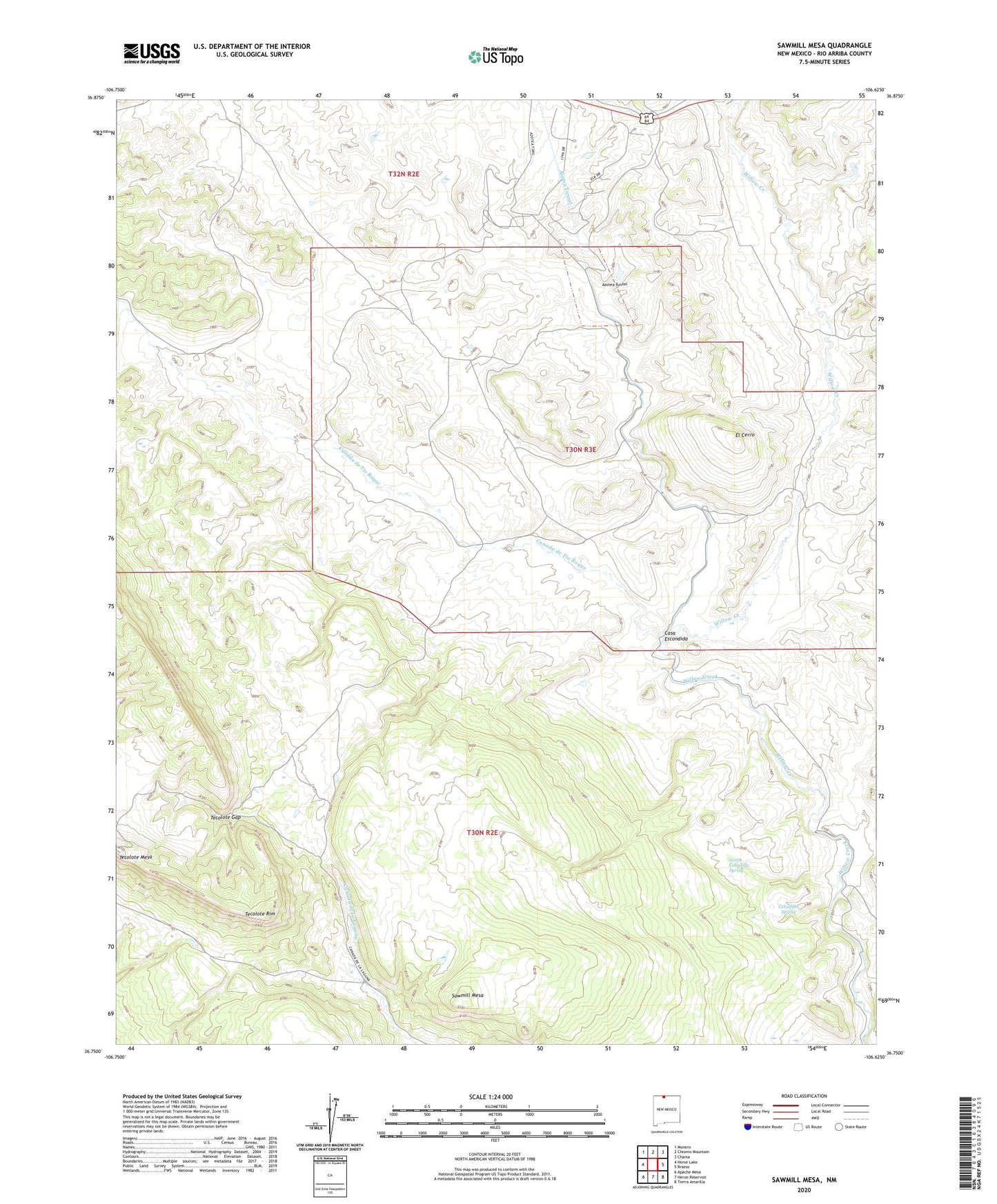
2020 topographic map quadrangle Sawmill Mesa in the state of New Mexico. Scale: 1:24000. Based on the newly updated USGS 7.5' US Topo map series, this map is in the following counties: Rio Arriba. The map contains contour data, water features, and other items you are used to seeing on USGS maps, but also has updated roads and other features. This is the next generation of topographic maps. Printed on high-quality waterproof paper with UV fade-resistant inks.
Quads adjacent to this one:
West: Horse Lake
Northwest: Monero
North: Chromo Mountain
Northeast: Chama
East: Brazos
Southeast: Tierra Amarilla
South: Heron Reservoir
Southwest: Apache Mesa
Contains the following named places: Azotea Tunnel, Canada de Tio Roque, Casa Escondida, Cebadilla Spring, El Cerro, North Cebadilla Spring, Sawmill Mesa, Tecolote Gap, Tecolote Mesa, V and M Ventures