MyTopo
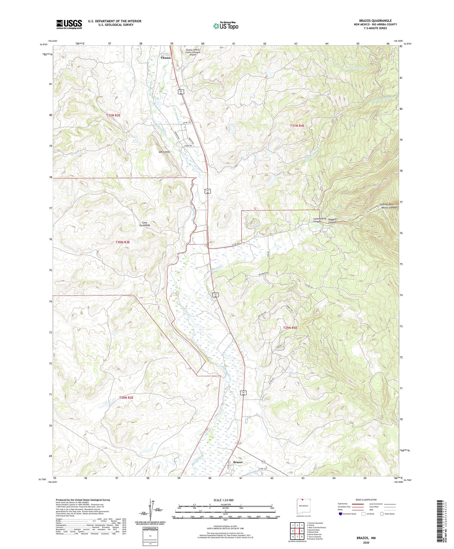
Brazos New Mexico US Topo Map
Couldn't load pickup availability
2023 topographic map quadrangle Brazos in the state of New Mexico. Scale: 1:24000. Based on the newly updated USGS 7.5' US Topo map series, this map is in the following counties: Rio Arriba. The map contains contour data, water features, and other items you are used to seeing on USGS maps, but also has updated roads and other features. This is the next generation of topographic maps. Printed on high-quality waterproof paper with UV fade-resistant inks.
Quads adjacent to this one:
West: Sawmill Mesa
Northwest: Chromo Mountain
North: Chama
Northeast: West Fork Rio Brazos
East: Brazos Peak
Southeast: Penasco Amarillo
South: Tierra Amarilla
Southwest: Heron Reservoir
This map covers the same area as the classic USGS quad with code o36106g5.
Contains the following named places: Brazos, Brazos Census Designated Place, Brazos Post Office, Canada de la Osa, Canones Box, Canones Creek, Canonizaria Canyon, Daggett Canyon, Dos Lomas, El Barranco Community Ditch Historic Site, Los Alamos Creek, Nestor Canyon, New Mexico State Forestry Division Chama District, Rio Chamita, Tierra Amarilla Grant, Willow Creek Mesa Ditch