MyTopo
Heron Reservoir New Mexico US Topo Map
Couldn't load pickup availability
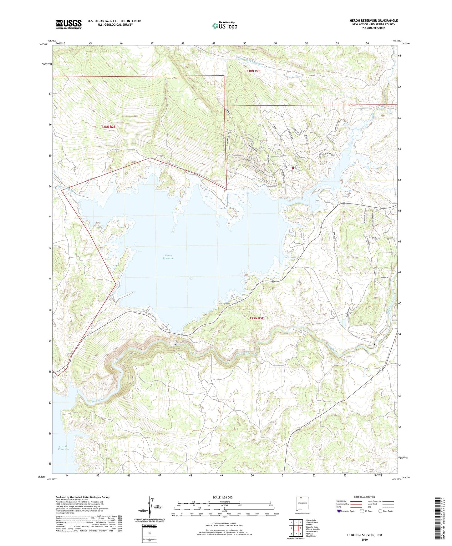
2023 topographic map quadrangle Heron Reservoir in the state of New Mexico. Scale: 1:24000. Based on the newly updated USGS 7.5' US Topo map series, this map is in the following counties: Rio Arriba. The map contains contour data, water features, and other items you are used to seeing on USGS maps, but also has updated roads and other features. This is the next generation of topographic maps. Printed on high-quality waterproof paper with UV fade-resistant inks.
Quads adjacent to this one:
West: Apache Mesa
Northwest: Horse Lake
North: Sawmill Mesa
Northeast: Brazos
East: Tierra Amarilla
Southeast: Las Nutrias
South: El Vado
Southwest: Pounds Mesa
This map covers the same area as the classic USGS quad with code o36106f6.
Contains the following named places: Canada de la Laguna, El Poso Ranch, El Vado State Park Airport, Heron Dam, Heron Dike, Heron Lake State Park, Heron Reservoir, Horse Lake Creek, Laguna Vista Estates Volunteer Fire Department, Rito de Tierra Amarilla, Willow Creek, ZIP Code: 87551