MyTopo
Shelley Peak New Mexico US Topo Map
Couldn't load pickup availability
Also explore the Shelley Peak Forest Service Topo of this same quad for updated USFS data
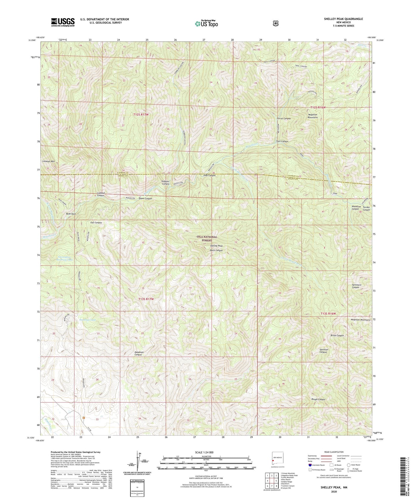
2023 topographic map quadrangle Shelley Peak in the state of New Mexico. Scale: 1:24000. Based on the newly updated USGS 7.5' US Topo map series, this map is in the following counties: Grant, Catron. The map contains contour data, water features, and other items you are used to seeing on USGS maps, but also has updated roads and other features. This is the next generation of topographic maps. Printed on high-quality waterproof paper with UV fade-resistant inks.
Quads adjacent to this one:
West: Rice Ranch
Northwest: Grouse Mountain
North: Mogollon Baldy Peak
Northeast: Lilley Mountain
East: Diablo Range
Southeast: Canyon Hill
South: Canteen Canyon
Southwest: Buckhorn
This map covers the same area as the classic USGS quad with code o33108b5.
Contains the following named places: Buds Hole, Corral Canyon, Deadman Canyon, Deadman Tank, Gobbler Canyon, Judy Canyon, Lookout Canyon, Lookout Canyon Trail, Lookout Mountain, Mogollon Creek Trail, Mogollon Mountains, Seventy Four Mountain Prospect, Seventyfour Mountain Tank, Shelley Peak, South Fork Mogollow Creek, Tepee Canyon, Trail Canyon, Turnbo Canyon, West Fork Mogollon Creek, West Fork Trail, Woodrow Canyon