MyTopo
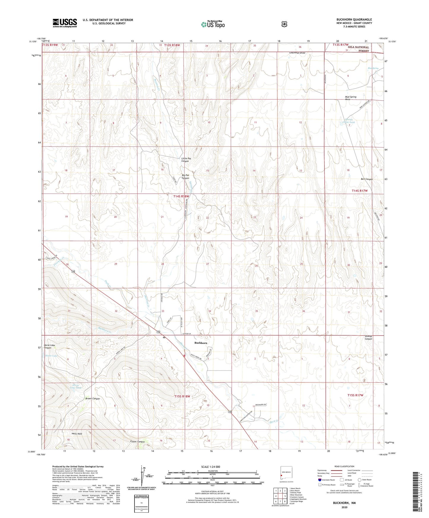
Buckhorn New Mexico US Topo Map
Couldn't load pickup availability
Also explore the Buckhorn Forest Service Topo of this same quad for updated USFS data
2023 topographic map quadrangle Buckhorn in the state of New Mexico. Scale: 1:24000. Based on the newly updated USGS 7.5' US Topo map series, this map is in the following counties: Grant. The map contains contour data, water features, and other items you are used to seeing on USGS maps, but also has updated roads and other features. This is the next generation of topographic maps. Printed on high-quality waterproof paper with UV fade-resistant inks.
Quads adjacent to this one:
West: Bear Mountain
Northwest: Moon Ranch
North: Rice Ranch
Northeast: Shelley Peak
East: Canteen Canyon
Southeast: Cliff
South: Antelope Ridge
Southwest: Applegate Mountain
This map covers the same area as the classic USGS quad with code o33108a6.
Contains the following named places: 10000 Water Well, 10008 Water Well, 88025, Big Pat Canyon, Brown Canyon, Buckhorn, Buckhorn Census Designated Place, Buckhorn Creek, Buckhorn Post Office, Buckhorn Store Water Well, Buckhorn Weather Station, Cliff Gila Volunteer Fire Department Buckhorn Station, Fivemile Creek, Foster Canyon, George Clark Tank, Hells Hole, Horse Lake, Horse Lake Tank, Little Pat Canyon, Mud Spring, Mud Spring Mesa, Sacaton Creek, Stevenson, The Dike