MyTopo
Sulphur Spring New Mexico US Topo Map
Couldn't load pickup availability
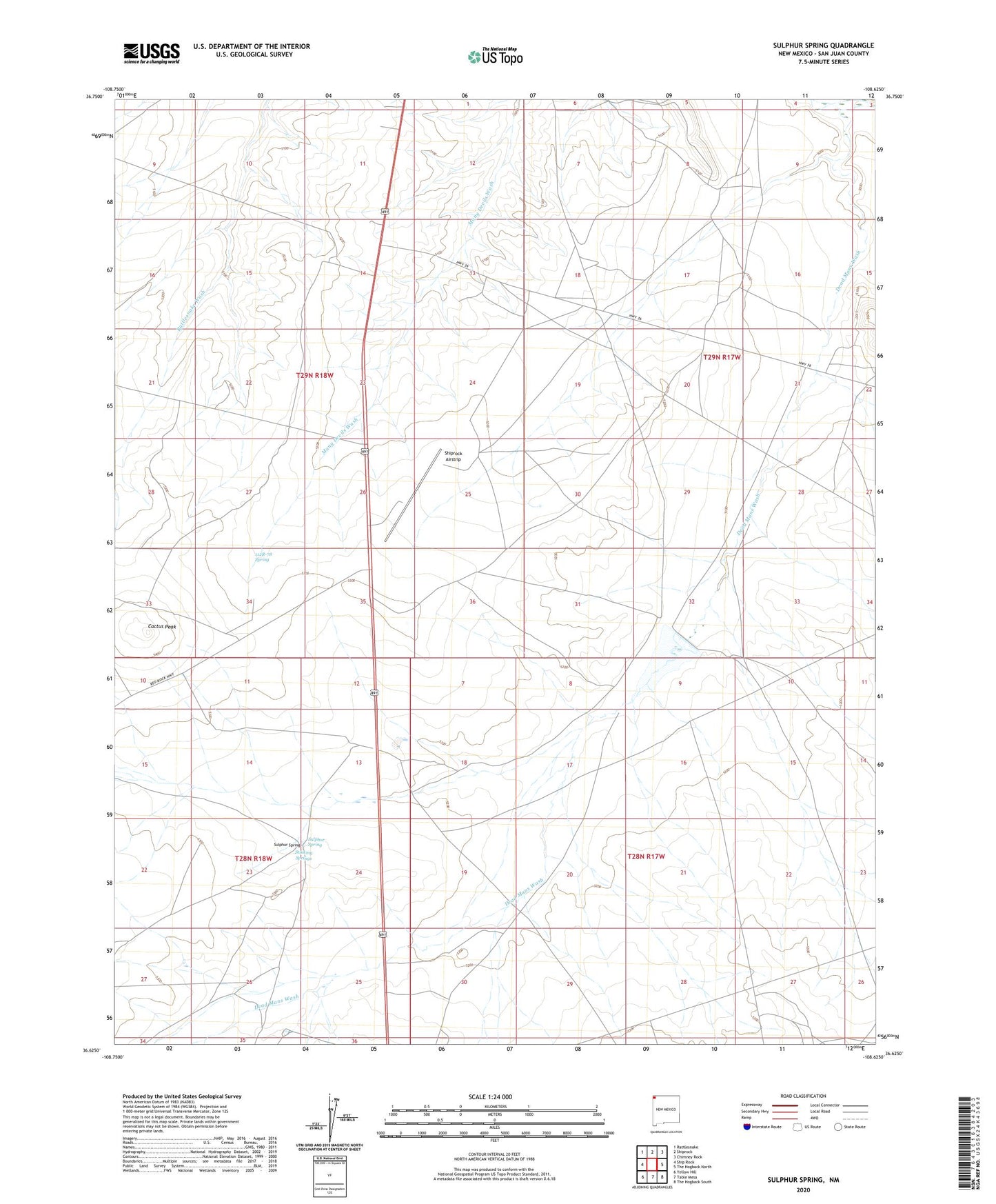
2020 topographic map quadrangle Sulphur Spring in the state of New Mexico. Scale: 1:24000. Based on the newly updated USGS 7.5' US Topo map series, this map is in the following counties: San Juan. The map contains contour data, water features, and other items you are used to seeing on USGS maps, but also has updated roads and other features. This is the next generation of topographic maps. Printed on high-quality waterproof paper with UV fade-resistant inks.
Quads adjacent to this one:
West: Ship Rock
Northwest: Rattlesnake
North: Shiprock
Northeast: Chimney Rock
East: The Hogback North
Southeast: The Hogback South
South: Table Mesa
Southwest: Yellow Hill
Contains the following named places: 112R-78 Spring, 12K-309 Water Well, 12T-551 Water Well, 12T-628 Water Well, 12T-629 Water Well, 12T-630 Water Well, Brewster Dam, Cactus Peak, Dead Mans Wash, Ship Rock Campground, Shiprock Airstrip, SJ-525 Water Well, Stinking Springs, Sulphur Spring, Sulphur Spring Campground