MyTopo
Puerto De Luna New Mexico US Topo Map
Couldn't load pickup availability
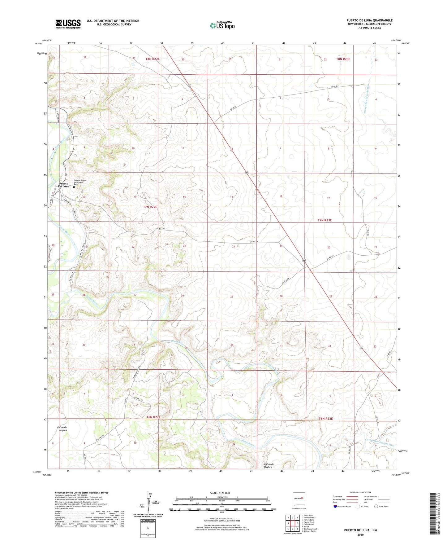
2023 topographic map quadrangle Puerto De Luna in the state of New Mexico. Scale: 1:24000. Based on the newly updated USGS 7.5' US Topo map series, this map is in the following counties: Guadalupe. The map contains contour data, water features, and other items you are used to seeing on USGS maps, but also has updated roads and other features. This is the next generation of topographic maps. Printed on high-quality waterproof paper with UV fade-resistant inks.
Quads adjacent to this one:
West: Puerto Creek
Northwest: Santa Rosa
North: Sunshine Mesa
Northeast: Harben Lake
East: Fallon Ranch
Southeast: Gibbons Ranch
South: Ojo Negro Creek
Southwest: Borica
This map covers the same area as the classic USGS quad with code o34104g5.
Contains the following named places: Arroyo San Juan de Dios, Canon de Hughes, Gerhardt, Monzingo, Nuestra Senora de Refugio Cemetery, Puerto Creek, Puerto De Luna, Puerto de Luna Census Designated Place, Puerto De Luna Post Office, Willis Ranch