MyTopo
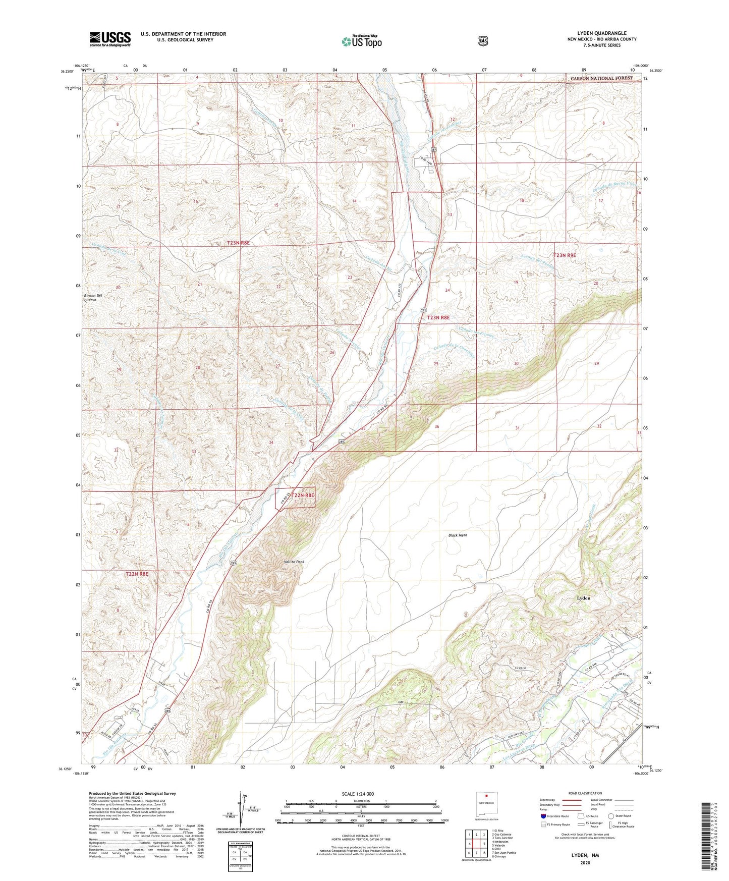
Lyden New Mexico US Topo Map
Couldn't load pickup availability
Also explore the Lyden Forest Service Topo of this same quad for updated USFS data
2023 topographic map quadrangle Lyden in the state of New Mexico. Scale: 1:24000. Based on the newly updated USGS 7.5' US Topo map series, this map is in the following counties: Rio Arriba. The map contains contour data, water features, and other items you are used to seeing on USGS maps, but also has updated roads and other features. This is the next generation of topographic maps. Printed on high-quality waterproof paper with UV fade-resistant inks.
Quads adjacent to this one:
West: Medanales
Northwest: El Rito
North: Ojo Caliente
Northeast: Taos Junction
East: Velarde
Southeast: Chimayo
South: San Juan Pueblo
Southwest: Chili
This map covers the same area as the classic USGS quad with code o36106b1.
Contains the following named places: Antonio de Abeyta Grant, Arroyo del Pueblo, Black Mesa Grant, Canada Abeque, Canada Ancha, Canada de Buena Vista, Canada de la Canelejas, Canada de la Cruz, Canada de Piedra, Canada las Lemitas, Canada los Alamos, Canada los Frijoles, El Medio Ditch, La Mesa Ditch, Layden Bentonite Deposit, Lyden, Lyden Census Designated Place, Lyden Post Office, RG-10052 Water Well, RG-10089 Water Well, RG-17833 Water Well, RG-19131 Water Well, RG-19887 Water Well, RG-22670 Water Well, RG-25763 Water Well, RG-32076 Water Well, RG-5626 Water Well, RG-7879 Water Well, RG-9894 Water Well, Rinconada Isla Ditch, Sandlin Arroyo, Torreon Indian Shop, Vallito Peak, ZIP Codes: 87549, 87582