MyTopo
Taos SW New Mexico US Topo Map
Couldn't load pickup availability
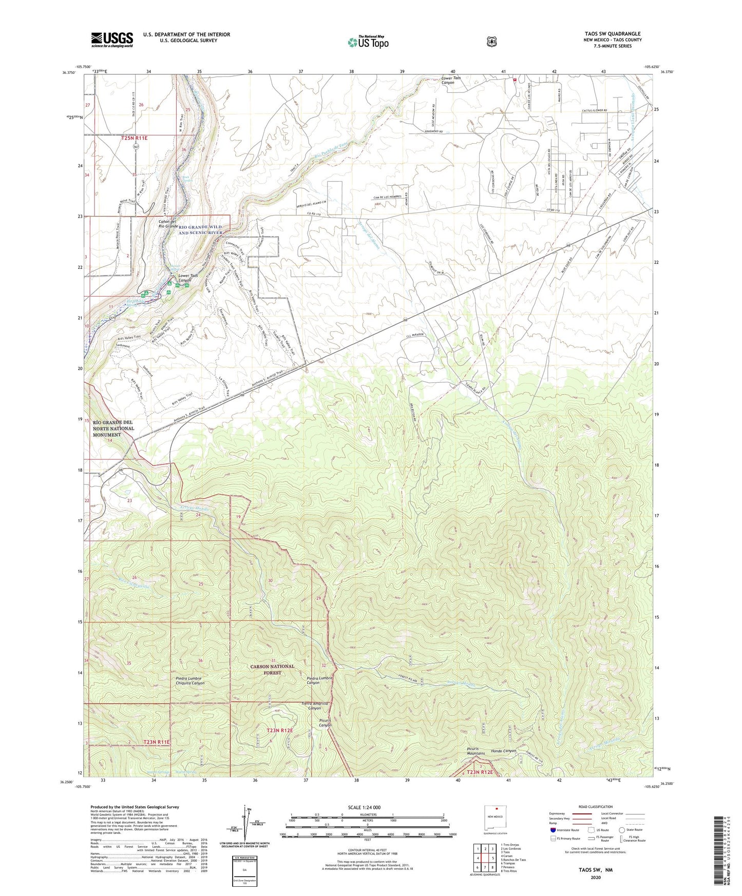
2020 topographic map quadrangle Taos SW in the state of New Mexico. Scale: 1:24000. Based on the newly updated USGS 7.5' US Topo map series, this map is in the following counties: Taos. The map contains contour data, water features, and other items you are used to seeing on USGS maps, but also has updated roads and other features. This is the next generation of topographic maps. Printed on high-quality waterproof paper with UV fade-resistant inks.
Quads adjacent to this one:
West: Carson
Northwest: Tres Orejas
North: Los Cordovas
Northeast: Taos
East: Ranchos De Taos
Southeast: Tres Ritos
South: Penasco
Southwest: Trampas
Contains the following named places: Acequia Llano Quemado, Arroyo del Alamo, Cristoval De La Serna Grant, Gijosa, Hondo Canyon, Lower Taos Canyon, Lunds Prospect, Orilla Verde, Paul Burch Pegmatite, Piedra Lumbre Chiquita Canyon, Rio Grande Spring, Rio Pueblo de Taos, Sunset Rapid, Taos Fire Department Station 3, Upper Hondo Canyon Prospect, Warm Spring, Warm Springs, ZIP Code: 87557