MyTopo
Tres Ritos New Mexico US Topo Map
Couldn't load pickup availability
Also explore the Tres Ritos Forest Service Topo of this same quad for updated USFS data
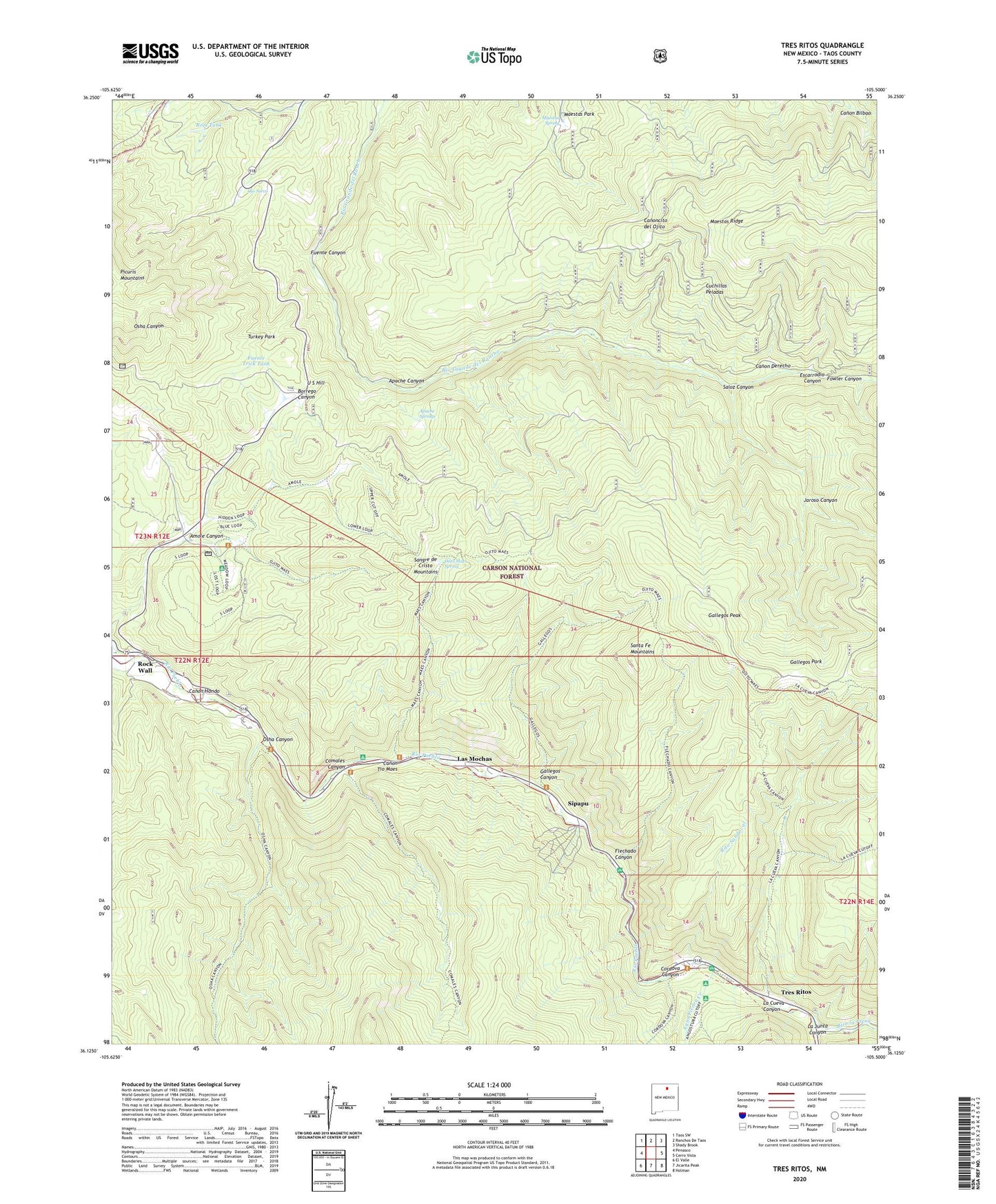
2023 topographic map quadrangle Tres Ritos in the state of New Mexico. Scale: 1:24000. Based on the newly updated USGS 7.5' US Topo map series, this map is in the following counties: Taos. The map contains contour data, water features, and other items you are used to seeing on USGS maps, but also has updated roads and other features. This is the next generation of topographic maps. Printed on high-quality waterproof paper with UV fade-resistant inks.
Quads adjacent to this one:
West: Penasco
Northwest: Taos SW
North: Ranchos De Taos
Northeast: Shady Brook
East: Cerro Vista
Southeast: Holman
South: Jicarita Peak
Southwest: El Valle
This map covers the same area as the classic USGS quad with code o36105b5.
Contains the following named places: Agua Piedra Campground, Agua Piedra Creek, Amole Canyon, Apache Canyon, Apache Springs, Camino Real Ranger District, Camp Summer Life, Canon Derecho, Canon Hondo, Canon Tio Maes, Comales Campground, Comales Canyon, Comales Sheep Driveway, Cordova Canyon, Cuchillas Peladas, Escarrodio Canyon, Flechado Canyon, Flechado Recreation Site, Flechado Trick Tank, Fowler Canyon, Fuente Canyon, Fuente Trick Tank, Gallegos Canyon, Gallegos Park, Gallegos Peak, Indian Creek, Jaroso Canyon, La Cueva Canyon, La Junta Canyon, Las Mochas, Limestone Quarry, Llanito Frio, Llanito Frio Recreation Site, Maestas Park, Maestas Ridge, Maestas Spring, North End Trail, Ojito Maes Spring, Ojo Sarco, Osha Canyon, Rito la Presa, Rito Sandoval, Rock Wall, Rojo Tank, Saloz Canyon, Santa Barbara Grant, Sipapu, Sipapu Ski Area, Taos Mill, Tojo Mine, Tres Ritos, Tres Ritos Post Office, Turkey Park, U S Hill, US Hill Mine