MyTopo
The Dyke New Mexico US Topo Map
Couldn't load pickup availability
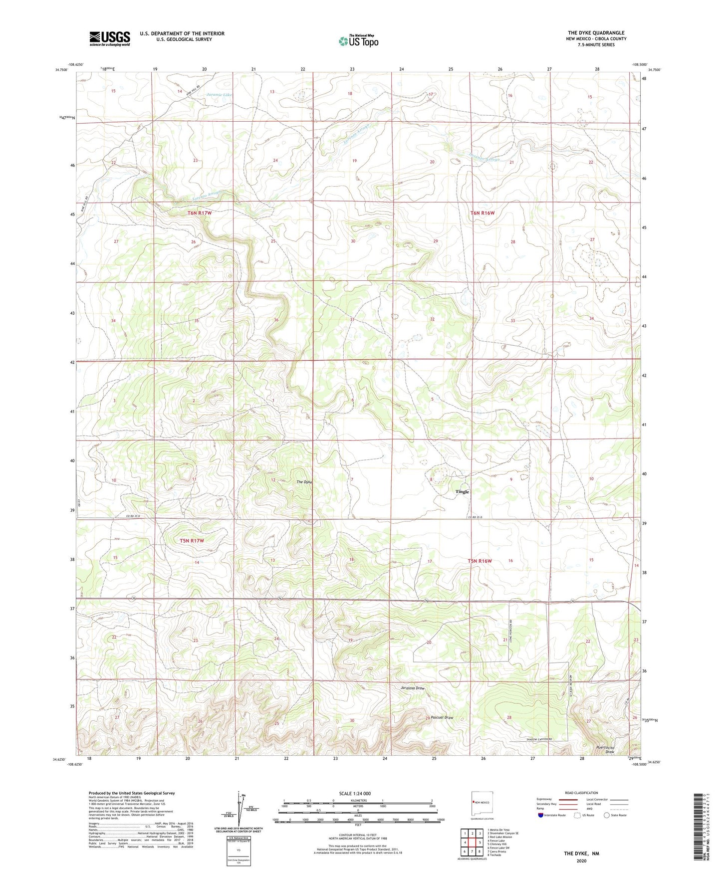
2020 topographic map quadrangle The Dyke in the state of New Mexico. Scale: 1:24000. Based on the newly updated USGS 7.5' US Topo map series, this map is in the following counties: Cibola. The map contains contour data, water features, and other items you are used to seeing on USGS maps, but also has updated roads and other features. This is the next generation of topographic maps. Printed on high-quality waterproof paper with UV fade-resistant inks.
Quads adjacent to this one:
West: Fence Lake
Northwest: Mesita De Yeso
North: Shoemaker Canyon SE
Northeast: Red Lake Mission
East: Chimney Hill
Southeast: Techado
South: Cerro Prieto
Southwest: Fence Lake SW
Contains the following named places: Gonzales Windmill, Hogan Windmill, Jaramie Lake, Juanito Well, Paz Water Well, Paz Well, Roe Well, The Dyke, Tingle, Tingle Post Office, White Ranch