MyTopo
Cerro Prieto New Mexico US Topo Map
Couldn't load pickup availability
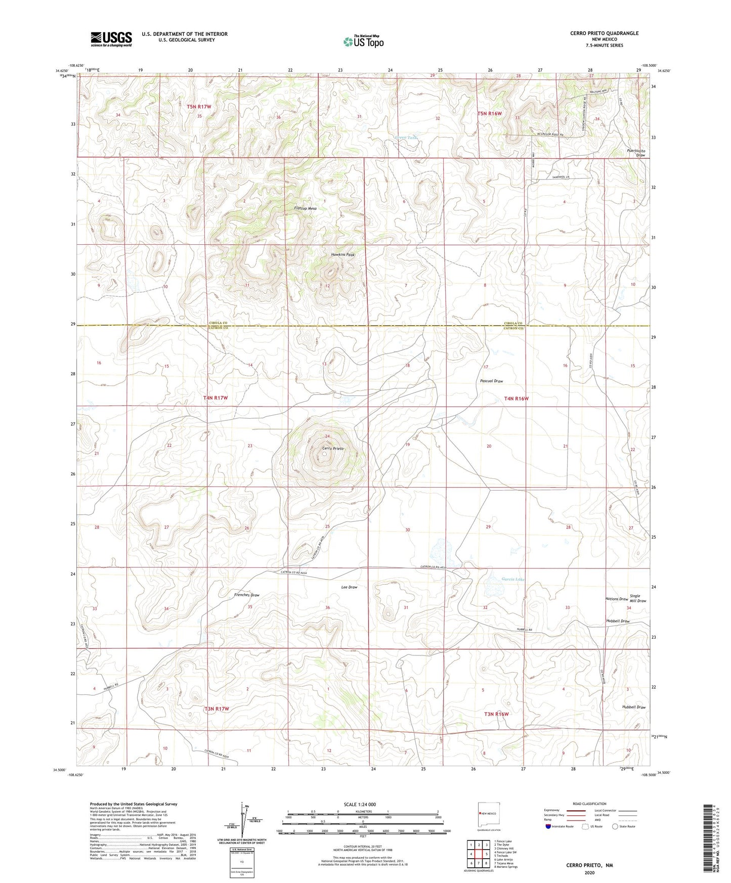
2023 topographic map quadrangle Cerro Prieto in the state of New Mexico. Scale: 1:24000. Based on the newly updated USGS 7.5' US Topo map series, this map is in the following counties: Catron, Cibola. The map contains contour data, water features, and other items you are used to seeing on USGS maps, but also has updated roads and other features. This is the next generation of topographic maps. Printed on high-quality waterproof paper with UV fade-resistant inks.
Quads adjacent to this one:
West: Fence Lake SW
Northwest: Fence Lake
North: The Dyke
Northeast: Chimney Hill
East: Techado
Southeast: Mariano Springs
South: Tejana Mesa
Southwest: Lake Armijo
This map covers the same area as the classic USGS quad with code o34108e5.
Contains the following named places: Apodaca Windmill, Cerro Prieto, Cerro Prieto Windmill, Dipping Vat Windmill, Flattop Mesa, Frenches Draw, Garcia Lake, Green Tank, Hawkins Peak, Hubbell Draw, Hubbell Ranch, Lee Draw, Lucero Water Well, Lucero Windmill, Martinez Windmill, Montano Ranch, Montano Well, Pascual Draw, Single Mill Draw, Taylor Windmill, Tejana Windmill, Williamson Ranch