MyTopo
Fence Lake SW New Mexico US Topo Map
Couldn't load pickup availability
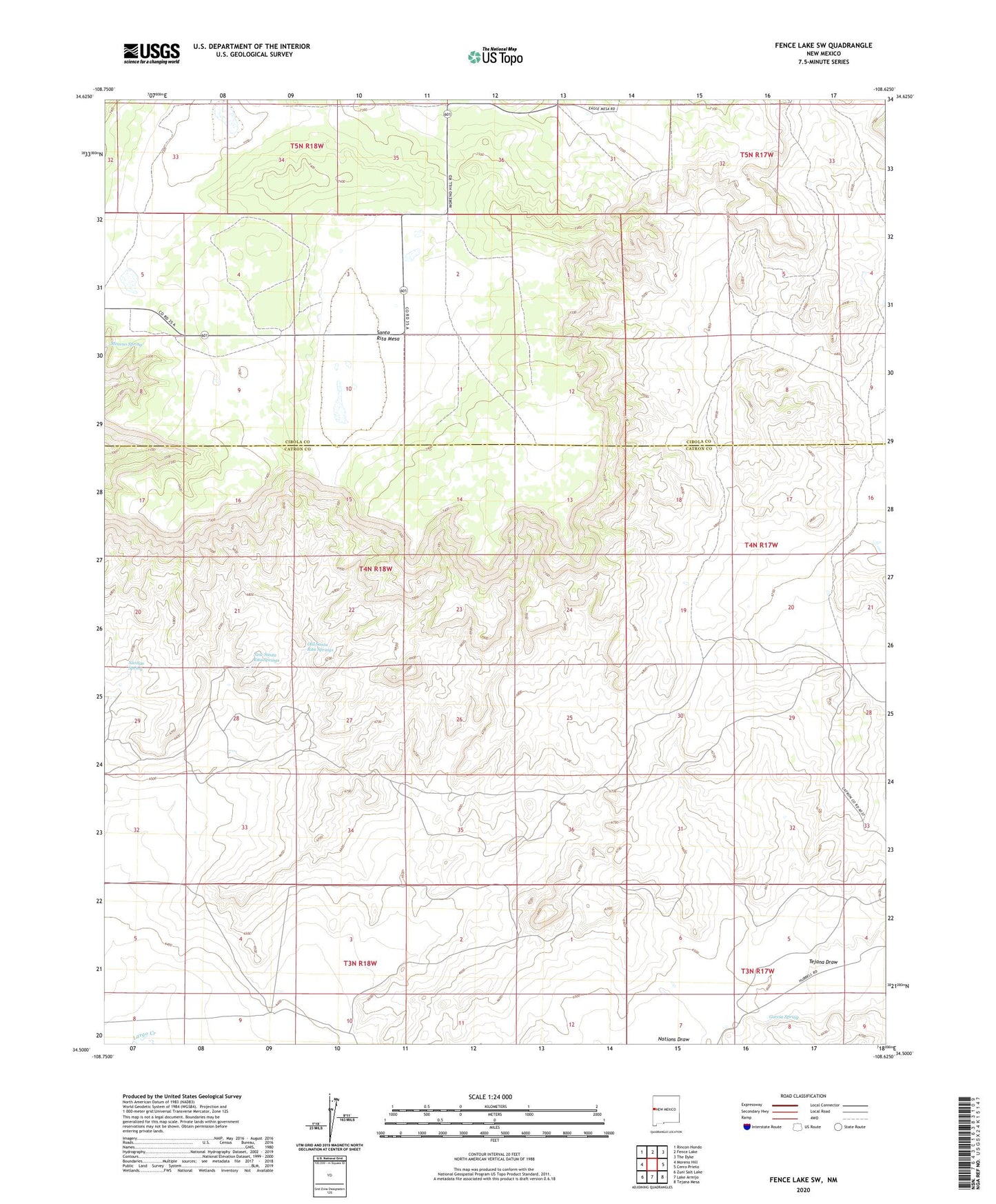
2023 topographic map quadrangle Fence Lake SW in the state of New Mexico. Scale: 1:24000. Based on the newly updated USGS 7.5' US Topo map series, this map is in the following counties: Catron, Cibola. The map contains contour data, water features, and other items you are used to seeing on USGS maps, but also has updated roads and other features. This is the next generation of topographic maps. Printed on high-quality waterproof paper with UV fade-resistant inks.
Quads adjacent to this one:
West: Moreno Hill
Northwest: Rincon Hondo
North: Fence Lake
Northeast: The Dyke
East: Cerro Prieto
Southeast: Tejana Mesa
South: Lake Armijo
Southwest: Zuni Salt Lake
This map covers the same area as the classic USGS quad with code o34108e6.
Contains the following named places: Carter Well, Cox Ranch, Escojeda Water Well, Escojeda Windmill, Garcia Spring, Medanoso Water Well, Medanoso Windmill, Moreno Spring, New Santa Rita Springs, New Santa Water Well, Nicolas Spring, Old Santa Rita Springs, Semi Lonesome Windmill, Tejana Draw