
MyTopo
Tolar New Mexico US Topo Map
Couldn't load pickup availability
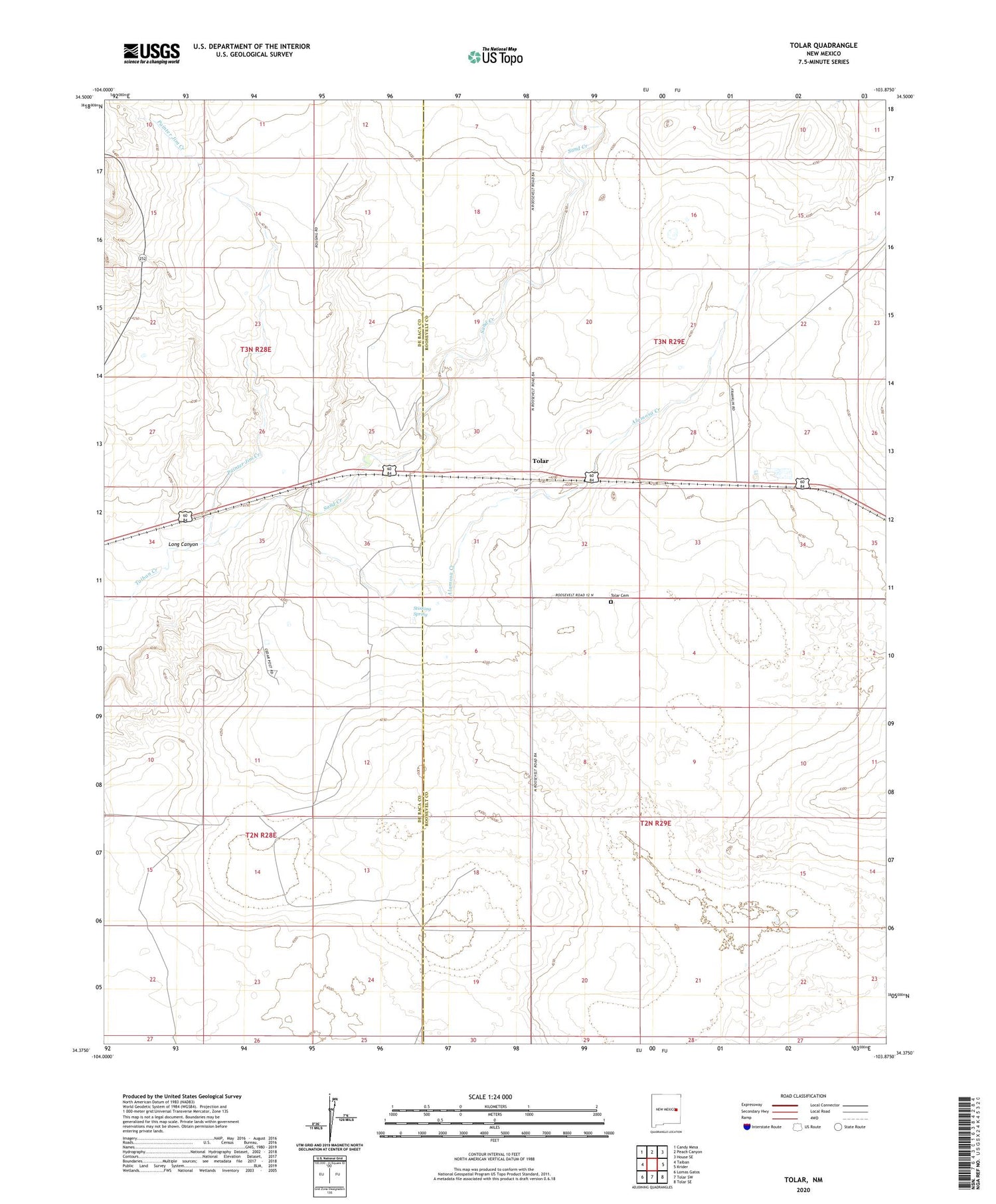
2020 topographic map quadrangle Tolar in the state of New Mexico. Scale: 1:24000. Based on the newly updated USGS 7.5' US Topo map series, this map is in the following counties: Roosevelt, De Baca. The map contains contour data, water features, and other items you are used to seeing on USGS maps, but also has updated roads and other features. This is the next generation of topographic maps. Printed on high-quality waterproof paper with UV fade-resistant inks.
Quads adjacent to this one:
West: Taiban
Northwest: Candy Mesa
North: Peach Canyon
Northeast: House SE
East: Krider
Southeast: Tolar SE
South: Tolar SW
Southwest: Lomas Gatos
Contains the following named places: Alamosa Creek, Cooper, East Bell Windmill, Gaddy Well, Lake Windmill, Long Canyon, Painter Jim Creek, Russell Well, Sand Creek, Stinking Spring, Tolar, Tolar Cemetery, Tolar Post Office


