MyTopo
Lomas Gatos New Mexico US Topo Map
Couldn't load pickup availability
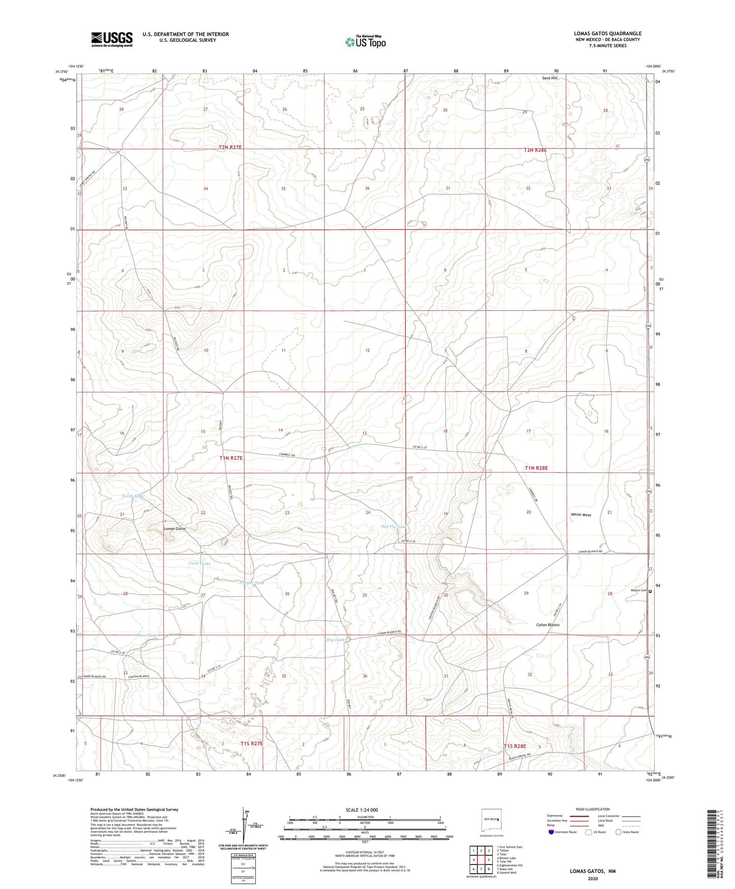
2023 topographic map quadrangle Lomas Gatos in the state of New Mexico. Scale: 1:24000. Based on the newly updated USGS 7.5' US Topo map series, this map is in the following counties: De Baca. The map contains contour data, water features, and other items you are used to seeing on USGS maps, but also has updated roads and other features. This is the next generation of topographic maps. Printed on high-quality waterproof paper with UV fade-resistant inks.
Quads adjacent to this one:
West: Bonner Lake
Northwest: Fort Sumner East
North: Taiban
Northeast: Tolar
East: Tolar SW
Southeast: Gammil Well
South: Watts Hill
Southwest: Eighteenmile Hill
This map covers the same area as the classic USGS quad with code o34104c1.
Contains the following named places: Blanco Cemetery, Bonner Well, Canyon Well, Dry Tank, East Headquarters Well, East Tank, East Well, Hall Ranch, Hanibus Well, Hopper Tank, Hutten Well, Lena Lewis Well, Lomas Gatos, Lone Tree Well, North Tank, Red Fry Tank, Sand Hill, Sand Hill Well, Sanders Well, South Sand Hill Well, Triangle Cattle Company, Triangle Ranch, Twin Tanks, West Headquarters Well, ZIP Code: 88134