MyTopo
Tolar SW New Mexico US Topo Map
Couldn't load pickup availability
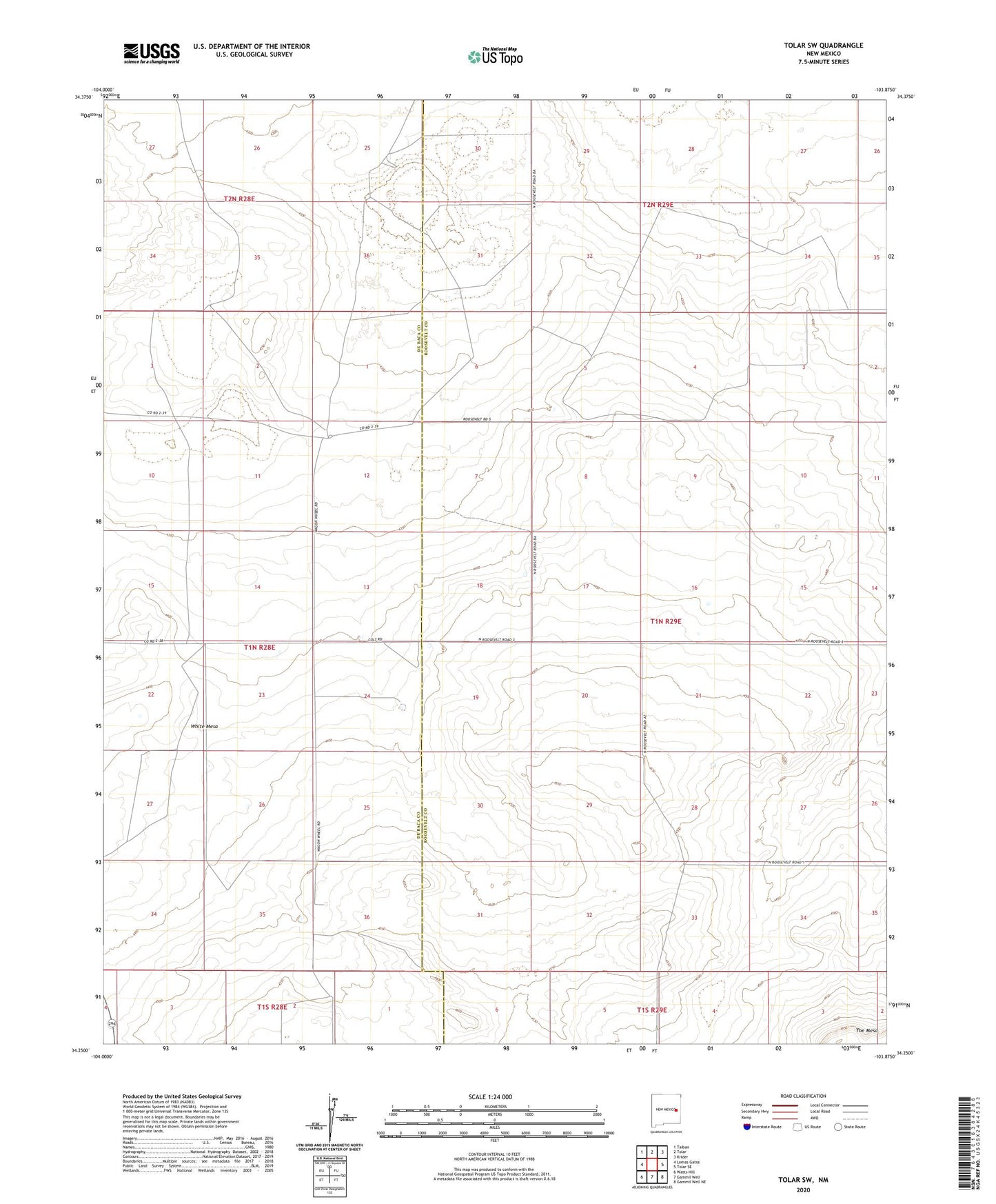
2023 topographic map quadrangle Tolar SW in the state of New Mexico. Scale: 1:24000. Based on the newly updated USGS 7.5' US Topo map series, this map is in the following counties: De Baca, Roosevelt. The map contains contour data, water features, and other items you are used to seeing on USGS maps, but also has updated roads and other features. This is the next generation of topographic maps. Printed on high-quality waterproof paper with UV fade-resistant inks.
Quads adjacent to this one:
West: Lomas Gatos
Northwest: Taiban
North: Tolar
Northeast: Krider
East: Tolar SE
Southeast: Gammil Well NE
South: Gammil Well
Southwest: Watts Hill
This map covers the same area as the classic USGS quad with code o34103c8.
Contains the following named places: DeReno Windmill, Diamond Windmill, Elliott Windmill, Finch Well, Fletcher Windmill, Fry Windmill, Leaning Windmill, Lewis Windmill, Noblitt Windmill, White Mesa, White Well