MyTopo
Toltec Mesa New Mexico US Topo Map
Couldn't load pickup availability
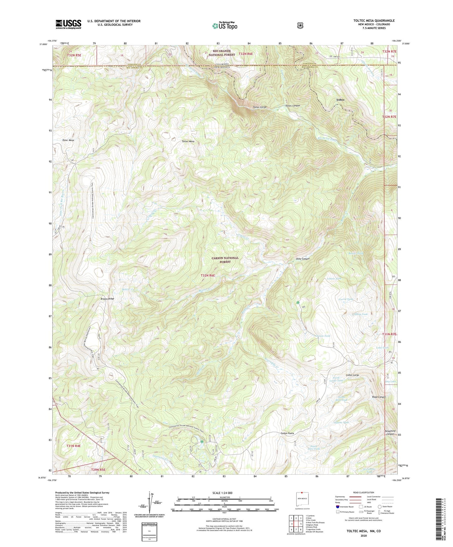
2020 topographic map quadrangle Toltec Mesa in the state of New Mexico. Scale: 1:24000. Based on the newly updated USGS 7.5' US Topo map series, this map is in the following counties: Rio Arriba, Conejos. The map contains contour data, water features, and other items you are used to seeing on USGS maps, but also has updated roads and other features. This is the next generation of topographic maps. Printed on high-quality waterproof paper with UV fade-resistant inks.
Quads adjacent to this one:
West: West Fork Rio Brazos
Northwest: Cumbres
North: Osier
Northeast: Fox Creek
East: Bighorn Peak
Southeast: Broke Off Mountain
South: Lagunitas Creek
Southwest: Brazos Peak
Contains the following named places: Beaver Creek, Beaver Tank, Brazos Ridge, Brazos Ridge Overlook, Corral Tank, Cruces Basin Wilderness, Cruces Creek, Diablo Creek, Dry Lake, East Fork Rio Brazos, El Camino Tank, Escondido Creek, Grouse Tank, Indian Tank, Lagunitas Guard Station, Lagunitas Tank, Lobato Tank, Lobo Creek, Lobo Tank, Lower Lagunitas Campground, Nelaganey Ranch, North Alire Tank, North Largo Tank, Osha Canyon, Osha Creek, Road Canyon, Sabino Tank, Sheep Tank, South Alire Tank, Telephone Canyon, Toltec, Toltec Canyon, Toltec Creek, Toltec Gorge, Toltec Mesa, Upper Lagunitas Campground, Upper Logunitas Campground, West Fork Rio Brazos