MyTopo
Osier Colorado US Topo Map
Couldn't load pickup availability
Also explore the Osier Forest Service Topo of this same quad for updated USFS data
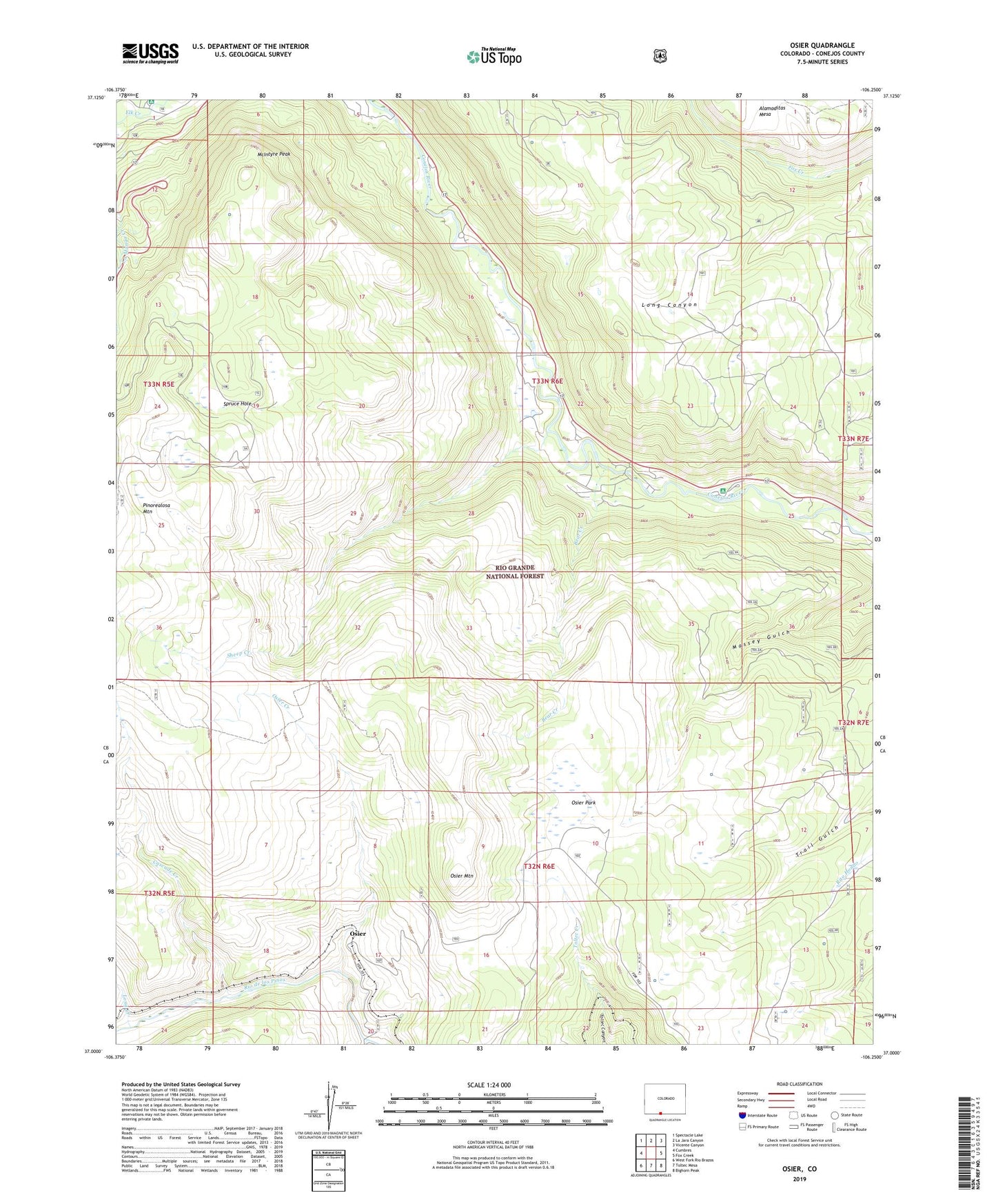
2022 topographic map quadrangle Osier in the state of Colorado. Scale: 1:24000. Based on the newly updated USGS 7.5' US Topo map series, this map is in the following counties: Conejos. The map contains contour data, water features, and other items you are used to seeing on USGS maps, but also has updated roads and other features. This is the next generation of topographic maps. Printed on high-quality waterproof paper with UV fade-resistant inks.
Quads adjacent to this one:
West: Cumbres
Northwest: Spectacle Lake
North: La Jara Canyon
Northeast: Vicente Canyon
East: Fox Creek
Southeast: Bighorn Peak
South: Toltec Mesa
Southwest: West Fork Rio Brazos
This map covers the same area as the classic USGS quad with code o37106a3.
Contains the following named places: Aspen Glade Campground, Bear Creek, Cascade Creek, Conejos Canyon Community Chapel, Dry Lake, Long Creek, McIntyre Peak, Menkhaven Ranch, Osier, Osier Creek, Osier Mountain, Osier Park, River Springs Ranger Station, Sheep Creek, Spruce Hole, Spruce Hole Trail, Trail Gulch Cow Camp