MyTopo
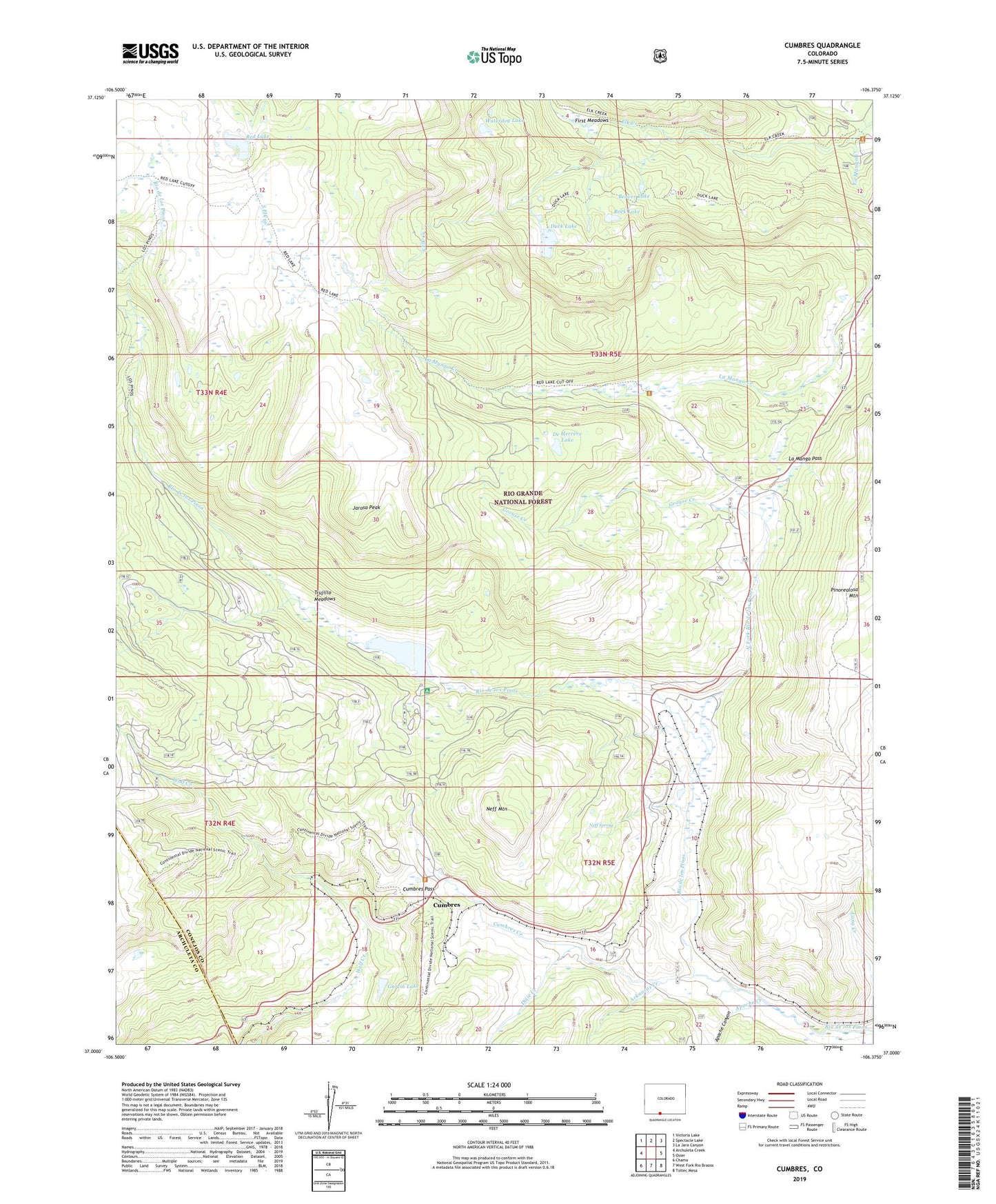
Cumbres Colorado US Topo Map
Couldn't load pickup availability
Also explore the Cumbres Forest Service Topo of this same quad for updated USFS data
2022 topographic map quadrangle Cumbres in the state of Colorado. Scale: 1:24000. Based on the newly updated USGS 7.5' US Topo map series, this map is in the following counties: Conejos, Archuleta. The map contains contour data, water features, and other items you are used to seeing on USGS maps, but also has updated roads and other features. This is the next generation of topographic maps. Printed on high-quality waterproof paper with UV fade-resistant inks.
Quads adjacent to this one:
West: Archuleta Creek
Northwest: Victoria Lake
North: Spectacle Lake
Northeast: La Jara Canyon
East: Osier
Southeast: Toltec Mesa
South: West Fork Rio Brazos
Southwest: Chama
This map covers the same area as the classic USGS quad with code o37106a4.
Contains the following named places: Apache Canyon, Apache Creek, Arkansas Creek, Beaver Lake, Cumbres, Cumbres Creek, Cumbres Pass, Cumbres Post Office, De Herrera Lake, Dixie Creek, Duck Lake, First Meadows, Garcia Lake, Grouse Creek, Jarosa Peak, La Manga Cow Camp, La Manga Creek, La Manga Pass, La Manga Stock Driveway, La Manga Summer Home Group, Los Pinos, Neff Mountain, Neff Spring, North Fork Rio de los Pinos, Pinorealosa Mountain, Posos Trail, Red Lake, Red Lake Trail, Rock Lake, South Elk Creek, Trujillo Meadows, Trujillo Meadows Campground, Trujillo Meadows Dam, Trujillo Meadows Reservoir, Waterdog Lake