MyTopo
Tres Orejas New Mexico US Topo Map
Couldn't load pickup availability
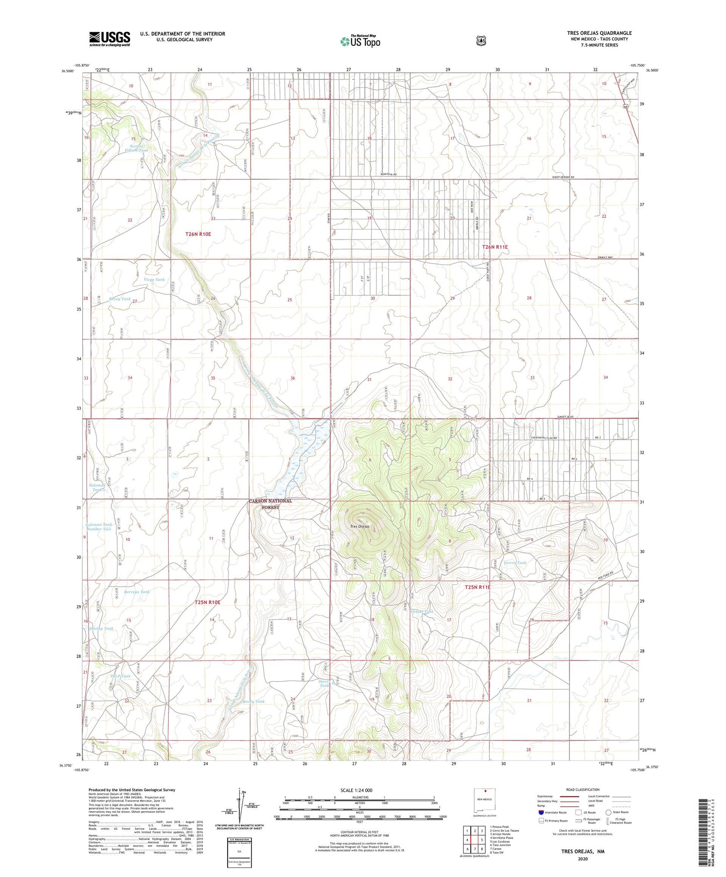
2020 topographic map quadrangle Tres Orejas in the state of New Mexico. Scale: 1:24000. Based on the newly updated USGS 7.5' US Topo map series, this map is in the following counties: Taos. The map contains contour data, water features, and other items you are used to seeing on USGS maps, but also has updated roads and other features. This is the next generation of topographic maps. Printed on high-quality waterproof paper with UV fade-resistant inks.
Quads adjacent to this one:
West: Servilleta Plaza
Northwest: Petaca Peak
North: Cerro De Los Taoses
Northeast: Arroyo Hondo
East: Los Cordovas
Southeast: Taos SW
South: Carson
Southwest: Taos Junction
Contains the following named places: Borrego Tank, Carson Reservoir, Carson Reservoir Dam, Dunlap Tank, Orejas Tank, Reveg Tank, Rocky Tank, Section Fifteen Tank, Soloman Tank, Soloman Tank Number Two, Stover Tank, Taos Resettlement Area, TCLP Tank, Torres Tank, Tres Orejas, Viego Tank, ZIP Code: 87517