MyTopo
Veguita New Mexico US Topo Map
Couldn't load pickup availability
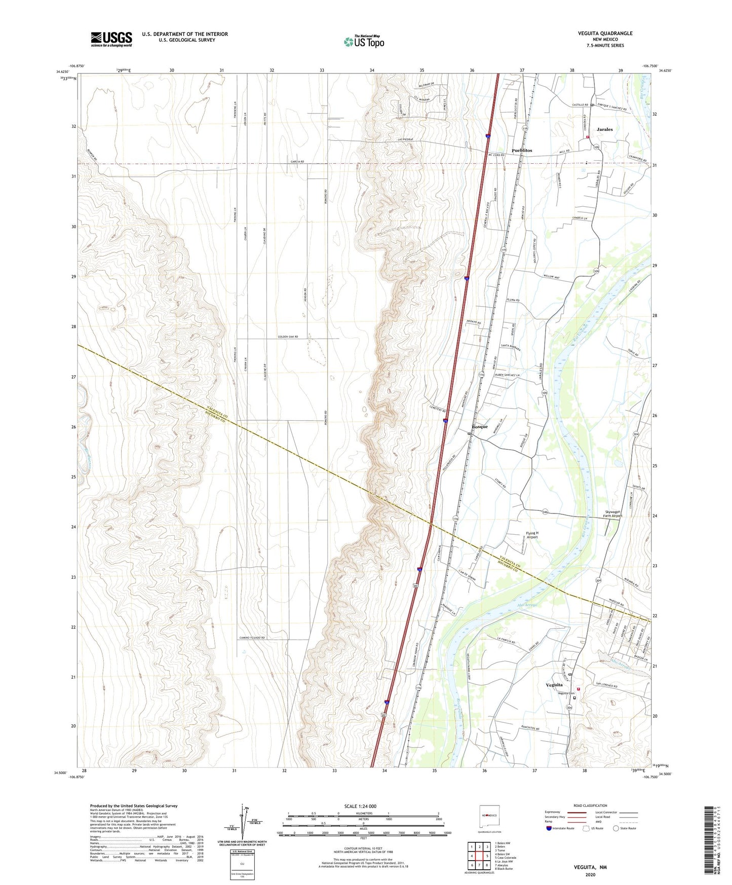
2020 topographic map quadrangle Veguita in the state of New Mexico. Scale: 1:24000. Based on the newly updated USGS 7.5' US Topo map series, this map is in the following counties: Valencia, Socorro. The map contains contour data, water features, and other items you are used to seeing on USGS maps, but also has updated roads and other features. This is the next generation of topographic maps. Printed on high-quality waterproof paper with UV fade-resistant inks.
Quads adjacent to this one:
West: Belen SW
Northwest: Belen NW
North: Belen
Northeast: Tome
East: Casa Colorada
Southeast: Black Butte
South: Abeytas
Southwest: La Joya NW
Contains the following named places: 10002 Water Well, 10003 Water Well, 10004 Water Well, 87023, Abo Arroyo, Arroyos Ditch, Belen Grant, Bosque, Bosque Drain, Bosque Post Office, Casa Colorada Canal, Casa Colorada Ditch, Casa Colorada Drain, Casa Colorada Grant, Casa Colorado del Sur Historic Site, Dust Bowl Home Historic Site, Flying H Airport, Garcia Ditch, Jaral Ditch, Jaral Lateral Number 2, Jarales, Jarales - Pueblitos Fire Department, Jarales Census Designated Place, Jarales Post Office, Lower Sabinal Riverside Drain, Luna Drain, Old Jarales Ditch, Pueblitos, Pueblitos Census Designated Place, Sabinal Ditch, Sabinal Lateral Number 1, Sabinal Lateral Number 2, Sabinal Siding, Sais Lateral, San Antonio Church, San Isidro Church, San Juan Canal, San Juan Church, Skywagon Farm Airport, Upper Sabinal Riverside Drain, Upper San Juan Riverside Drain, Veguita, Veguita Cemetery, Veguita Census Designated Place, Veguita Post Office, Veguita Volunteer Fire Department