MyTopo
Belen NW New Mexico US Topo Map
Couldn't load pickup availability
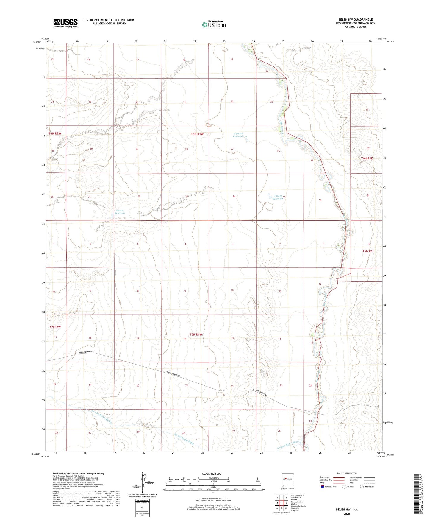
2023 topographic map quadrangle Belen NW in the state of New Mexico. Scale: 1:24000. Based on the newly updated USGS 7.5' US Topo map series, this map is in the following counties: Valencia. The map contains contour data, water features, and other items you are used to seeing on USGS maps, but also has updated roads and other features. This is the next generation of topographic maps. Printed on high-quality waterproof paper with UV fade-resistant inks.
Quads adjacent to this one:
West: Mesas Mojinas
Northwest: South Garcia SE
North: Rio Puerco
Northeast: Dalies
East: Belen
Southeast: Veguita
South: Belen SW
Southwest: Comanche Ranch
This map covers the same area as the classic USGS quad with code o34106f8.
Contains the following named places: 10023 Water Well, 10025 Water Well, Arroyo Monte Belen, Escondido Reservoir, Flack Well, Gabaladon Reservoir, Guzman Reservoir, Metate Reservoir, Popalito Water Well, Popalito Windmill, Pueblo Windmill, Shearing Corral Windmill, Shell Water Well, Target Reservoir