MyTopo
Abeytas New Mexico US Topo Map
Couldn't load pickup availability
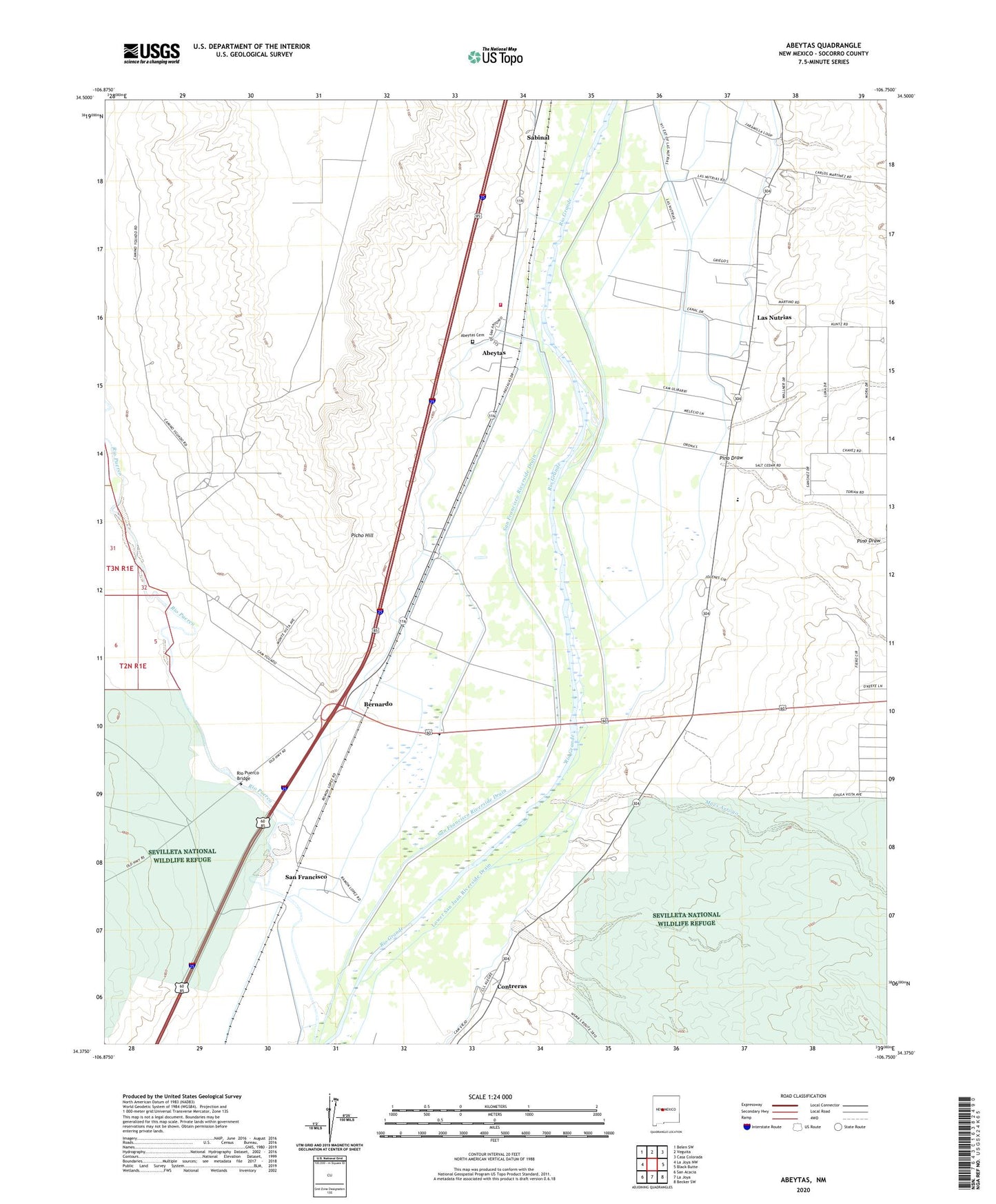
2023 topographic map quadrangle Abeytas in the state of New Mexico. Scale: 1:24000. Based on the newly updated USGS 7.5' US Topo map series, this map is in the following counties: Socorro. The map contains contour data, water features, and other items you are used to seeing on USGS maps, but also has updated roads and other features. This is the next generation of topographic maps. Printed on high-quality waterproof paper with UV fade-resistant inks.
Quads adjacent to this one:
West: La Joya NW
Northwest: Belen SW
North: Veguita
Northeast: Casa Colorada
East: Black Butte
Southeast: Becker SW
South: La Joya
Southwest: San Acacia
This map covers the same area as the classic USGS quad with code o34106d7.
Contains the following named places: 10019 Water Well, 87006, 87028, Abeytas, Abeytas Cemetery, Abeytas Census Designated Place, Abeytas Fire Department, Abeytas Post Office, Belen Grant Lateral Number One, Bernado State Game Refuge, Bernardo, Bernardo Post Office, Canada Colorada, Contreras, Contreras Post Office, La Joya Ditch, Las Nutrias, Las Nutrias Census Designated Place, Las Nutrias Drain, Las Nutrias Lateral, Lower San Juan Riverside Drain, Maes Arroyo, New Mexico Boys Ranch, Picho Hill, Pino Draw, Rio Puerco Bridge, Sabinal, Sabinal Post Office, San Francisco, San Francisco Lateral, San Francisco Post Office, San Francisco Riverside Drain, San Isidro Church, San Juan Ditch, San Juan Drain, Santa Barbara Church, Torres Water Well, Yguado Dom Water Well, Yguado Irrigation Water Well