MyTopo
Venadito Camp New Mexico US Topo Map
Couldn't load pickup availability
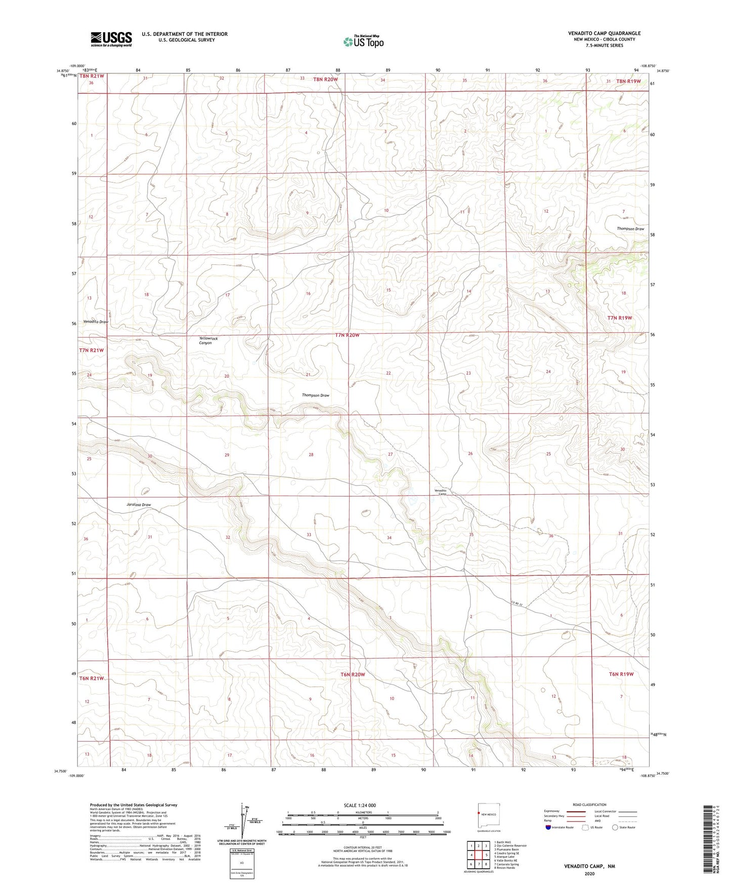
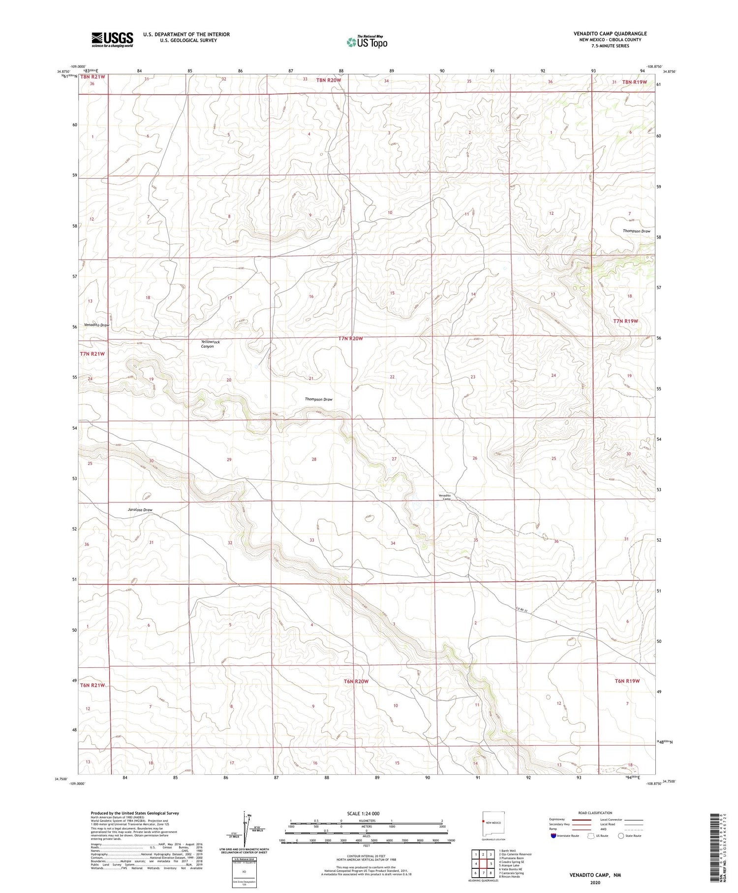
2020 topographic map quadrangle Venadito Camp in the state of New Mexico. Scale: 1:24000. Based on the newly updated USGS 7.5' US Topo map series, this map is in the following counties: Cibola. The map contains contour data, water features, and other items you are used to seeing on USGS maps, but also has updated roads and other features. This is the next generation of topographic maps. Printed on high-quality waterproof paper with UV fade-resistant inks.
Quads adjacent to this one:
West: Ceadro Spring SE
Northwest: Barth Well
North: Ojo Caliente Reservoir
Northeast: Plumasano Basin
East: Atarque Lake
Southeast: Rincon Hondo
South: Cantaralo Spring
Southwest: Valle Bonito NE
Contains the following named places: Camp Windmill Water Well, Dominion Water Well, Padilla Water Well, Sandoval Water Well, Sandoval Windmill, Thompson Draw, Venadito Water Well, Venadito Windmill, Venado Water Well, Venado Well, Venedito Camp, Windmill 9 Water Well, Windmill Number 9, Yellowrock Canyon