MyTopo
Rincon Hondo New Mexico US Topo Map
Couldn't load pickup availability
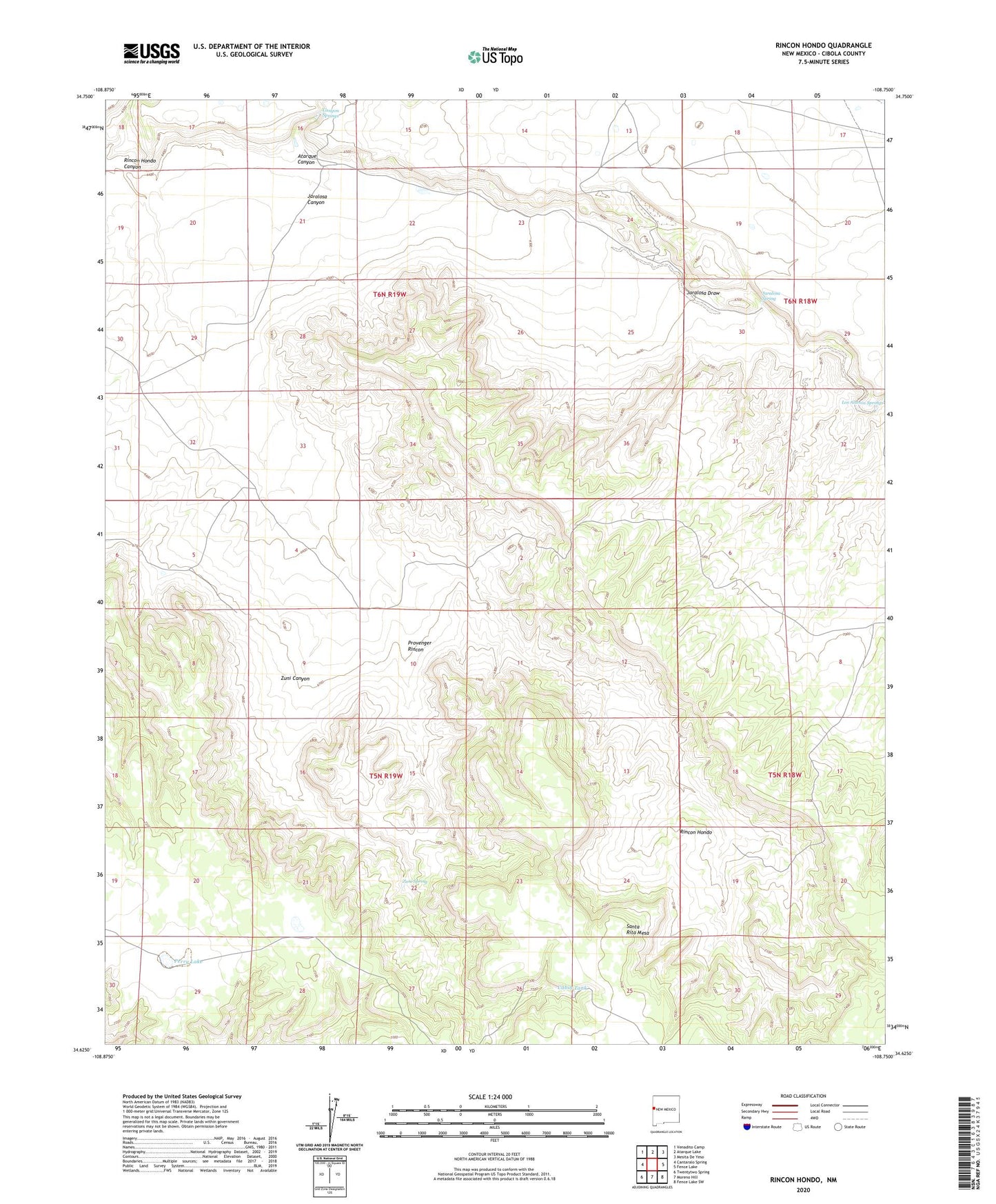
2023 topographic map quadrangle Rincon Hondo in the state of New Mexico. Scale: 1:24000. Based on the newly updated USGS 7.5' US Topo map series, this map is in the following counties: Cibola. The map contains contour data, water features, and other items you are used to seeing on USGS maps, but also has updated roads and other features. This is the next generation of topographic maps. Printed on high-quality waterproof paper with UV fade-resistant inks.
Quads adjacent to this one:
West: Cantaralo Spring
Northwest: Venadito Camp
North: Atarque Lake
Northeast: Mesita De Yeso
East: Fence Lake
Southeast: Fence Lake SW
South: Moreno Hill
Southwest: Twentytwo Spring
This map covers the same area as the classic USGS quad with code o34108f7.
Contains the following named places: Amado Windmill, Atarque Canyon, Cabin Tank, Canyon Springs, Crow Windmill, Fort Atarque Ruins, Jaralosa Canyon, Jaralosa Spring, Jaralosa Windmill, Perry Lake, Provenger Rincon, Rincon Camp, Rincon Camp Water Well, Rincon Hondo, Rincon Hondo Canyon, Rincon Hondo Windmill, Rock House Windmill, South Camp Water Well, South Camp Windmill, Zuni Canyon, Zuni Spring