MyTopo
Waterflow New Mexico US Topo Map
Couldn't load pickup availability
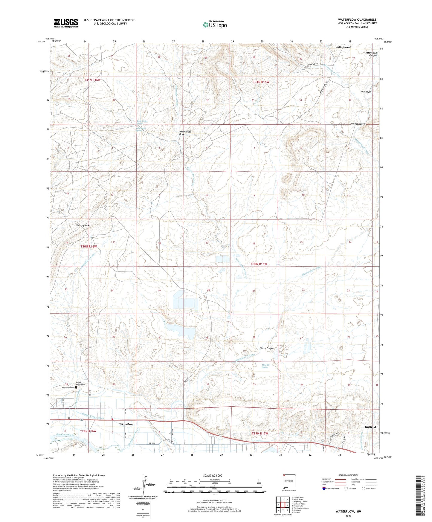
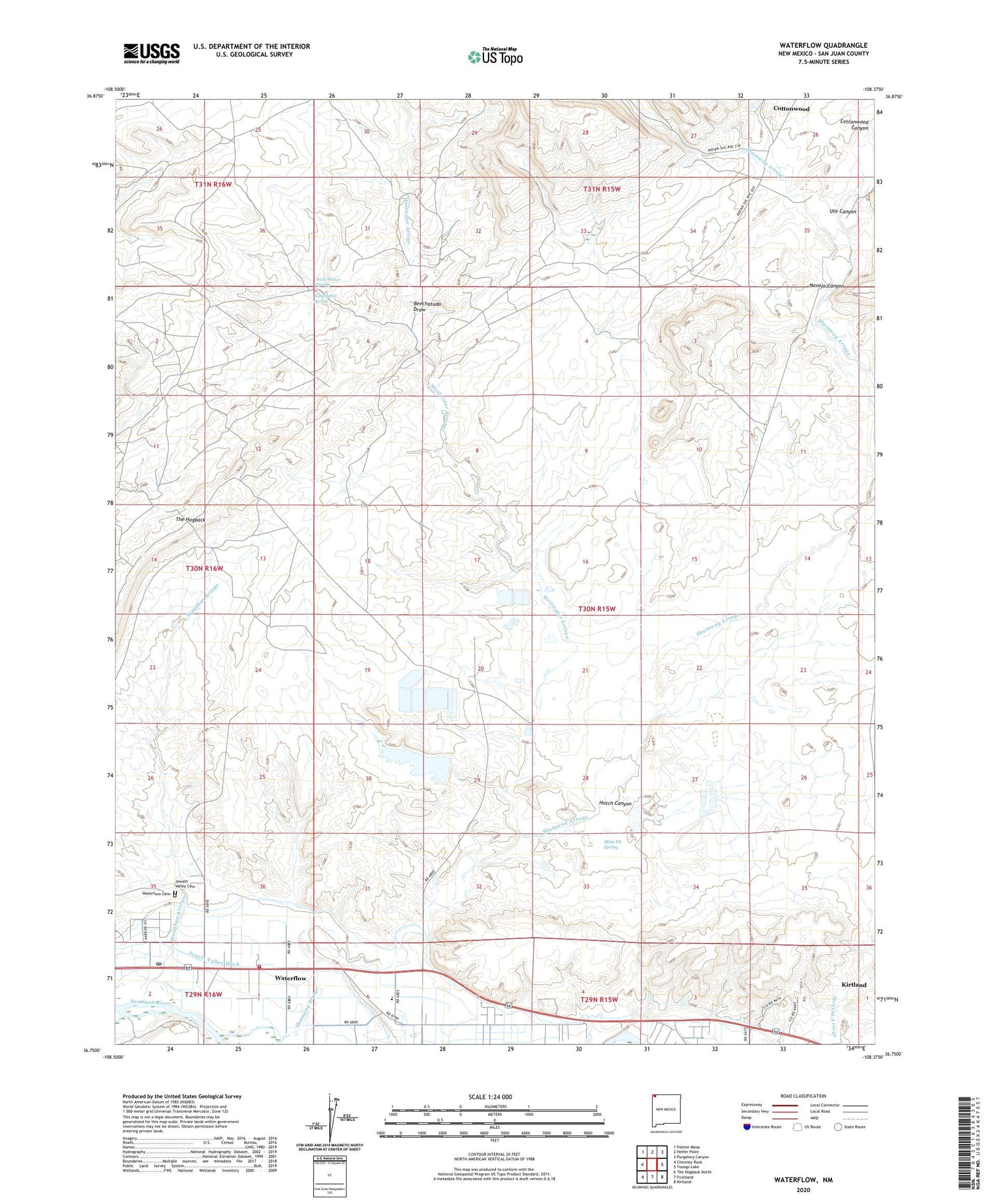
2020 topographic map quadrangle Waterflow in the state of New Mexico. Scale: 1:24000. Based on the newly updated USGS 7.5' US Topo map series, this map is in the following counties: San Juan. The map contains contour data, water features, and other items you are used to seeing on USGS maps, but also has updated roads and other features. This is the next generation of topographic maps. Printed on high-quality waterproof paper with UV fade-resistant inks.
Quads adjacent to this one:
West: Chimney Rock
Northwest: Palmer Mesa
North: Heifer Point
Northeast: Purgatory Canyon
East: Youngs Lake
Southeast: Kirtland
South: Fruitland
Southwest: The Hogback North
Contains the following named places: Abbe Young Mine, Adamson Mines, Beechatuda Draw, Black Diamond Mines, Brimhall Mine, Cottonwood, Cottonwood Canyon, Farmers Mutual Ditch, Hendrickson Mine, Hutch Canyon, Jack Boyd, Jewett Valley Cemetery, Jewett Valley Ditch, Mine Pit Spring, Narrows Wash, Navajo Canyon, PS A Water Well, PS B Water Well, Sacred Heart Academy, Sacred Heart Cemetery, San Juan County Fire District 1 - Valley Station 3, San Juan Power Generation Dam, San Juan Power Generation Reservoir, San Juan Underground Test Mine, Scanlon Mine, Shiprock Substation, Shumway Arroyo, SJ-23-4 Water Well, Smouse Mines, Stalling Mine, The Meadows, Ute Canyon, Verde Oil Field, Walker Mine, Waterflow, Waterflow Cemetery, Waterflow Census Designated Place, Waterflow Pit, Waterflow Post Office, Waughan Arroyo, West Water Spring, Westwater Arroyo, Westwater Spring, Zia Trading Post