MyTopo
Purgatory Canyon New Mexico US Topo Map
Couldn't load pickup availability
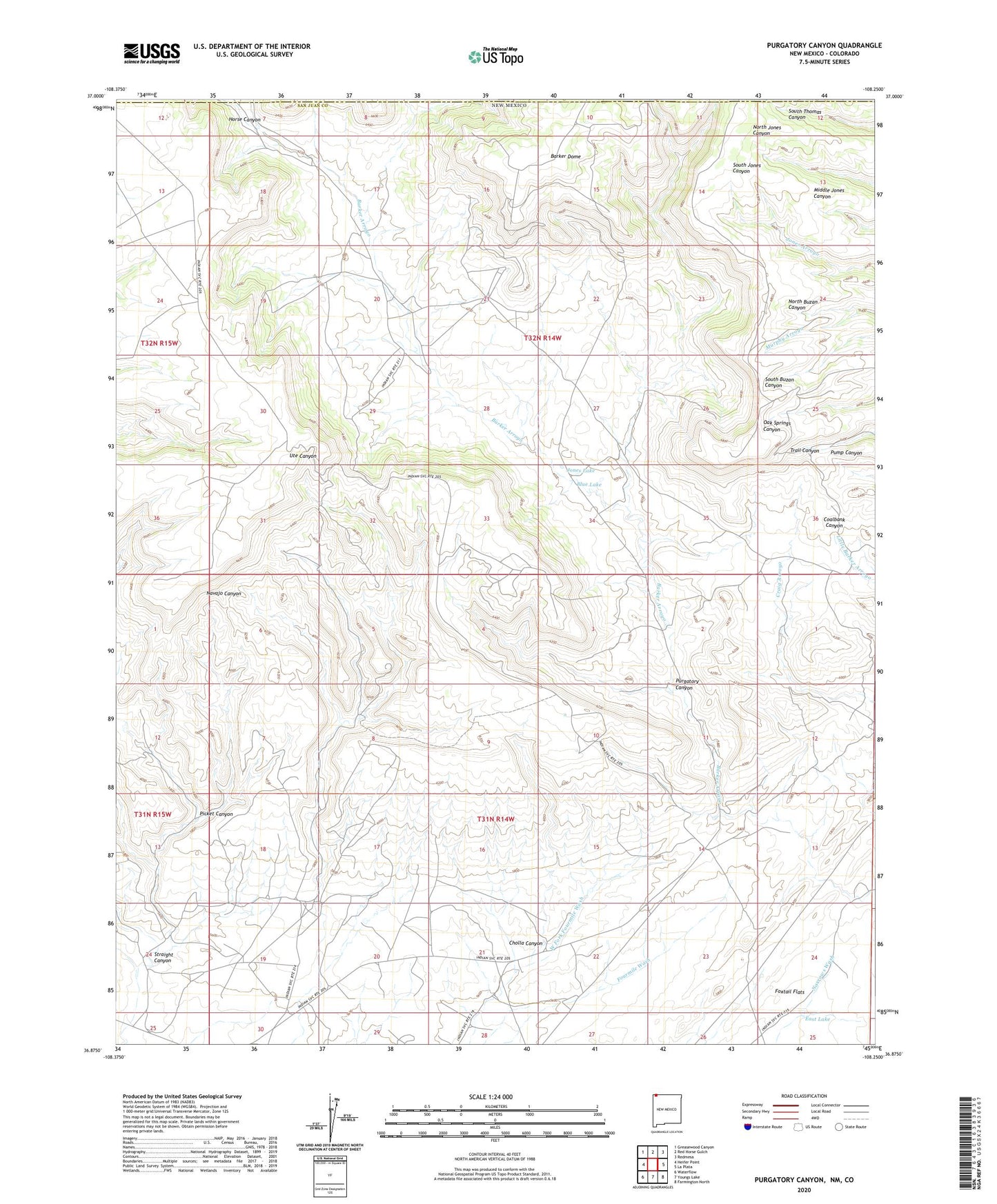
2023 topographic map quadrangle Purgatory Canyon in the state of New Mexico. Scale: 1:24000. Based on the newly updated USGS 7.5' US Topo map series, this map is in the following counties: San Juan, La Plata. The map contains contour data, water features, and other items you are used to seeing on USGS maps, but also has updated roads and other features. This is the next generation of topographic maps. Printed on high-quality waterproof paper with UV fade-resistant inks.
Quads adjacent to this one:
West: Heifer Point
Northwest: Greasewood Canyon
North: Red Horse Gulch
Northeast: Redmesa
East: La Plata
Southeast: Farmington North
South: Youngs Lake
Southwest: Waterflow
This map covers the same area as the classic USGS quad with code o36108h3.
Contains the following named places: A-13 Water Well, A-17 Water Well, Baker Dome Well, Barker Dome, Blue Lake, Cholla Canyon, East Lake, Horse Canyon, Jones Lake, Little Barker Arroyo, Mokie Indian Ruin, Picket Canyon, Purgatory Canyon, Straight Canyon