MyTopo
West Fork Rio Brazos New Mexico US Topo Map
Couldn't load pickup availability
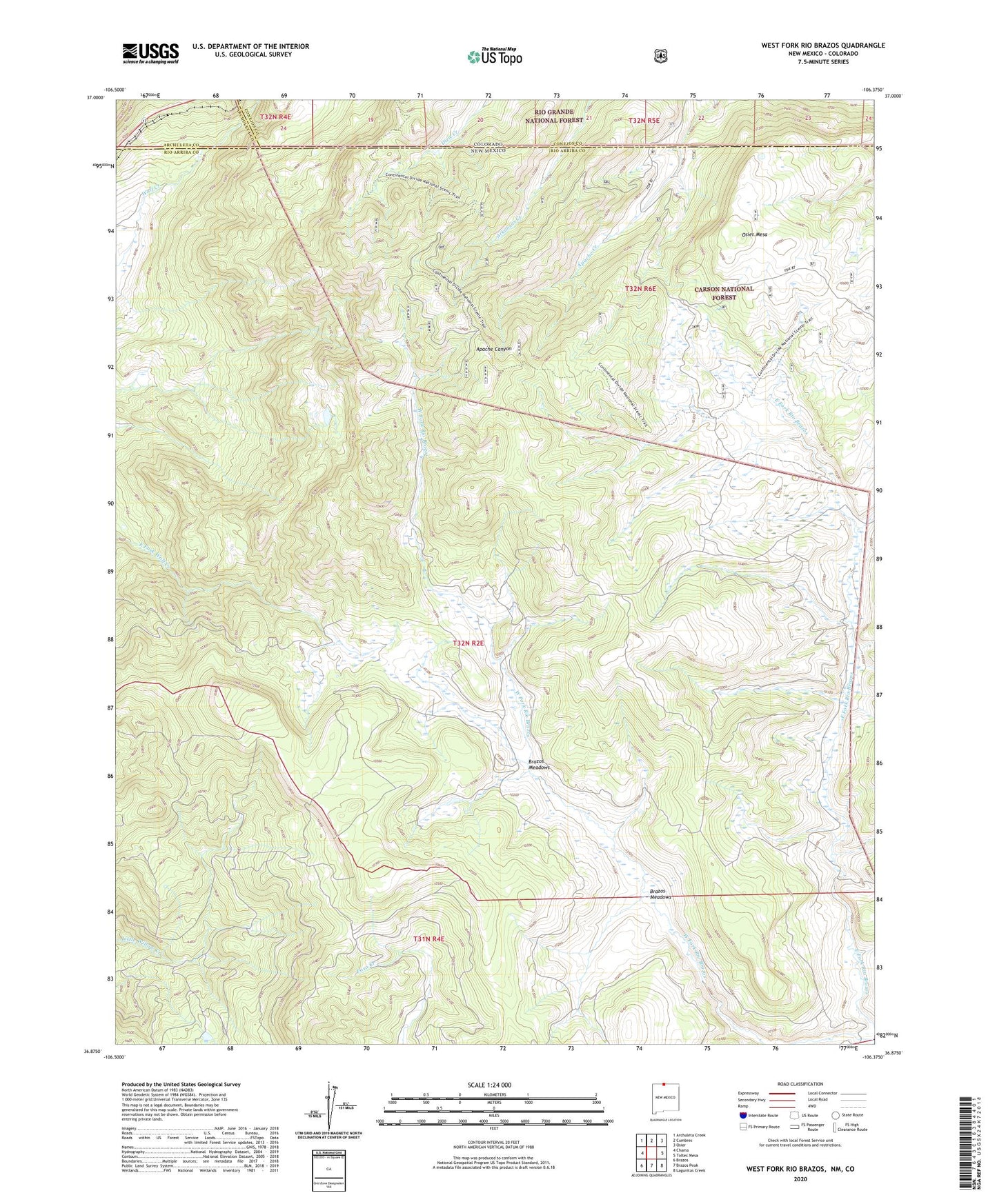
2020 topographic map quadrangle West Fork Rio Brazos in the states of New Mexico, Colorado. Scale: 1:24000. Based on the newly updated USGS 7.5' US Topo map series, this map is in the following counties: Rio Arriba, Conejos, Archuleta. The map contains contour data, water features, and other items you are used to seeing on USGS maps, but also has updated roads and other features. This is the next generation of topographic maps. Printed on high-quality waterproof paper with UV fade-resistant inks.
Quads adjacent to this one:
West: Chama
Northwest: Archuleta Creek
North: Cumbres
Northeast: Osier
East: Toltec Mesa
Southeast: Lagunitas Creek
South: Brazos Peak
Southwest: Brazos
Contains the following named places: Apache Forest Service Facility, Brazos Meadows, Burn Cow Camp, Cresco, Dean Lake, Huffaker Cabin, Mesa Lake, Osier Fork Rio Brazos, Osier Mesa, Rivera Cow Camp