MyTopo
West Lime Hills New Mexico US Topo Map
Couldn't load pickup availability
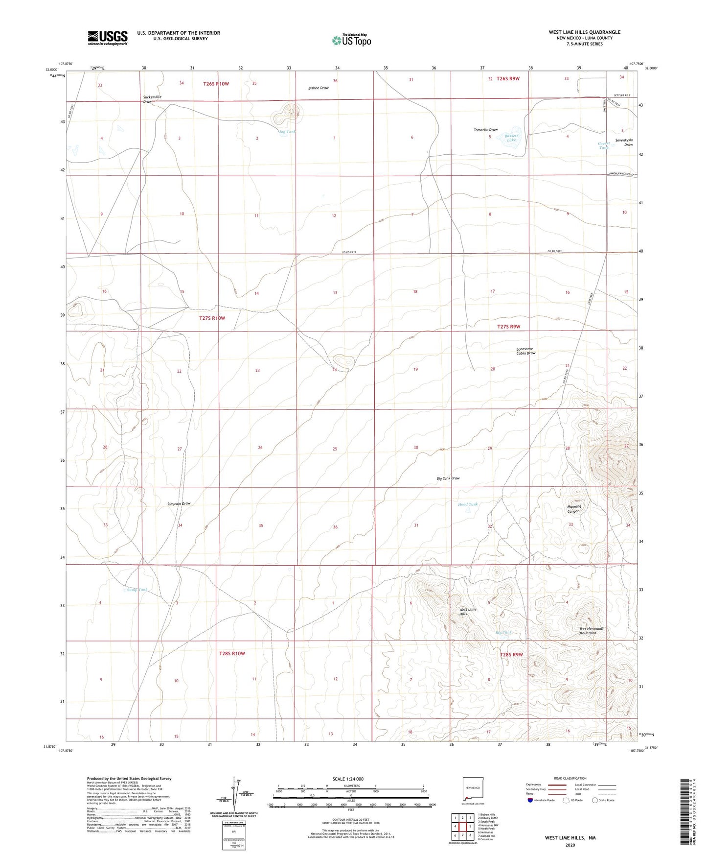
2020 topographic map quadrangle West Lime Hills in the state of New Mexico. Scale: 1:24000. Based on the newly updated USGS 7.5' US Topo map series, this map is in the following counties: Luna. The map contains contour data, water features, and other items you are used to seeing on USGS maps, but also has updated roads and other features. This is the next generation of topographic maps. Printed on high-quality waterproof paper with UV fade-resistant inks.
Quads adjacent to this one:
West: Hermanas NW
Northwest: Bisbee Hills
North: Midway Butte
Northeast: South Peak
East: North Peak
Southeast: Columbus
South: Malpais Hill
Southwest: Hermanas
Contains the following named places: 00941 Water Well, 00942 Water Well, 00952 Water Well, 01072 Water Well, 01073 Water Well, 01076 Water Well, 016067 Water Well, 01630 Water Well, 01631 Water Well, 01632 Water Well, 01634 Water Well, 01669 Water Well, 05027 Water Well, 06042 Water Well, 06044 Water Well, 10387 Water Well, 10388 Water Well, Bassett Lake, Big Tank, Big Tank Draw, Bisbee Draw, Black Hawk, Cincinnati, Covert Tank, Hancock, Hood Tank, Jog Tank, Jog Windmill, Lake Windmill, Lonesome Cabin Draw, Mahoney Mines, Mahoney Mining Area, Manning Canyon, Marie, Suckerville Draw, Sump Tank, Swope Windmill, Tomerlin Draw, West Lime Hills, White House Ranch