MyTopo
Bisbee Hills New Mexico US Topo Map
Couldn't load pickup availability
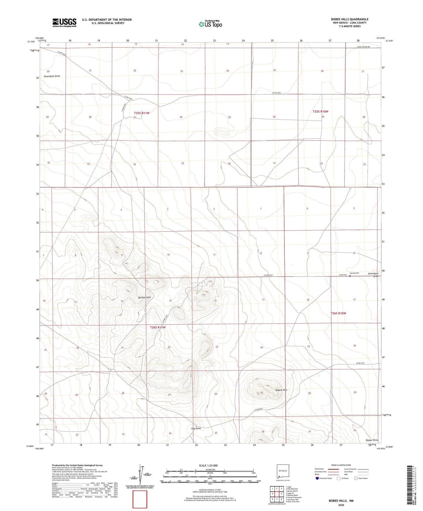
2023 topographic map quadrangle Bisbee Hills in the state of New Mexico. Scale: 1:24000. Based on the newly updated USGS 7.5' US Topo map series, this map is in the following counties: Luna. The map contains contour data, water features, and other items you are used to seeing on USGS maps, but also has updated roads and other features. This is the next generation of topographic maps. Printed on high-quality waterproof paper with UV fade-resistant inks.
Quads adjacent to this one:
West: Gage SE
Northwest: Gage
North: Red Mountain
Northeast: Bowlin Ranch
East: Midway Butte
Southeast: West Lime Hills
South: Hermanas NW
Southwest: Flying W Mountain
This map covers the same area as the classic USGS quad with code o32107a8.
Contains the following named places: 00774 Water Well, 00849 Water Well, 00858 Water Well, 00865 Water Well, 00866 Water Well, 01415 Water Well, 01418 Water Well, 01419 Water Well, 01477 Water Well, 01478 Water Well, 06019 Water Well, 06082 Water Well, Big Digging Mines, Bisbee Hills, Bisbee Windmill, Burdick Hills, Carroll Cemetery, Elenwood, Eller Place, Farm Well, Gap Draw, Miller Ranch, Miller-Gibson Detention Dam Number 1, Miller-Gibson Detention Dam Number 2, Porcher Windmill, Seventysix Well, Stringer Ranch