MyTopo
South Peak New Mexico US Topo Map
Couldn't load pickup availability
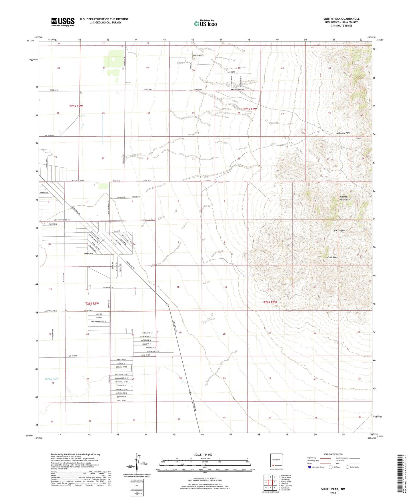
2023 topographic map quadrangle South Peak in the state of New Mexico. Scale: 1:24000. Based on the newly updated USGS 7.5' US Topo map series, this map is in the following counties: Luna. The map contains contour data, water features, and other items you are used to seeing on USGS maps, but also has updated roads and other features. This is the next generation of topographic maps. Printed on high-quality waterproof paper with UV fade-resistant inks.
Quads adjacent to this one:
West: Midway Butte
Northwest: Bowlin Ranch
North: Capitol Dome
Northeast: Florida Gap
East: Gym Peak
Southeast: Columbus NE
South: North Peak
Southwest: West Lime Hills
This map covers the same area as the classic USGS quad with code o32107a6.
Contains the following named places: 00659 Water Well, 00660 Water Well, 00718 Water Well, 00719 Water Well, 00720 Water Well, 00721 Water Well, 00722 Water Well, 00725 Water Well, 00726 Water Well, 00804 Water Well, 00806 Water Well, 00807 Water Well, 00808 Water Well, 00811 Water Well, 00812 Water Well, 00813 Water Well, 00814 Water Well, 00828 Water Well, 00829 Water Well, 00832 Water Well, 00837 Water Well, 01436 Water Well, 06011 Water Well, 06146 Water Well, 10306 Water Well, 10326 Water Well, 10327 Water Well, 10328 Water Well, 10329 Water Well, 10338 Water Well, 10339 Water Well, 10349 Water Well, 10350 Water Well, 10352 Water Well, Big Pocket-Florida Mountains Area, Crawford Ranch, Mahoney Park, McBee Windmill, Palayo Tank, Park, Shaw Prospect, South Peak, South Side, White Hills