MyTopo
White Flat SE New Mexico US Topo Map
Couldn't load pickup availability
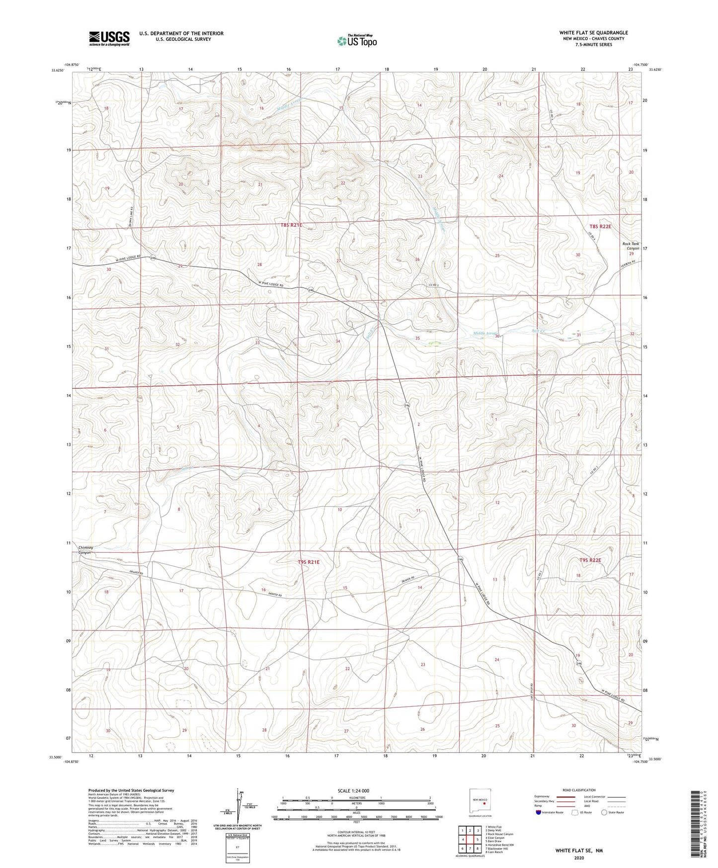
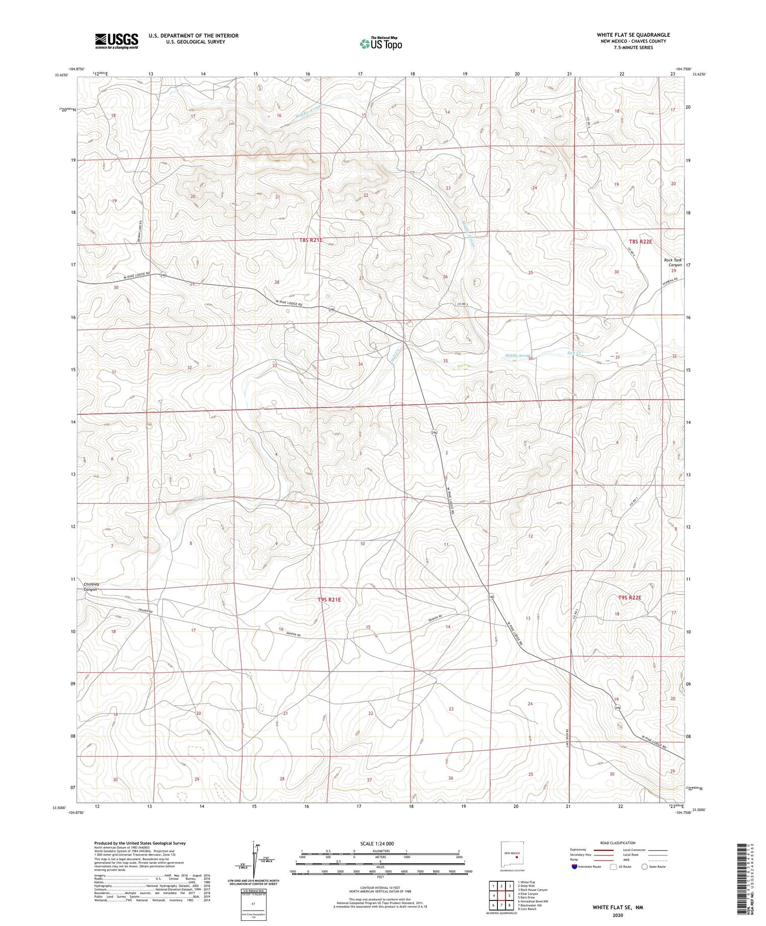
2020 topographic map quadrangle White Flat SE in the state of New Mexico. Scale: 1:24000. Based on the newly updated USGS 7.5' US Topo map series, this map is in the following counties: Chaves. The map contains contour data, water features, and other items you are used to seeing on USGS maps, but also has updated roads and other features. This is the next generation of topographic maps. Printed on high-quality waterproof paper with UV fade-resistant inks.
Quads adjacent to this one:
West: Elsie Canyon
Northwest: White Flat
North: Deep Well
Northeast: Rock House Canyon
East: Barn Draw
Southeast: Corn Ranch
South: Blackwater Hill
Southwest: Horseshoe Bend NW
Contains the following named places: Big Creek Windmill, Childress Ranch, Chimney Canyon, Corn Ranch, Koy Ranch, Middle Arroyo, Middle Arroyo Well, New Windmill, North Well, Partnership Windmill, Rock Tank Well, South Windmill