MyTopo
Elsie Canyon New Mexico US Topo Map
Couldn't load pickup availability
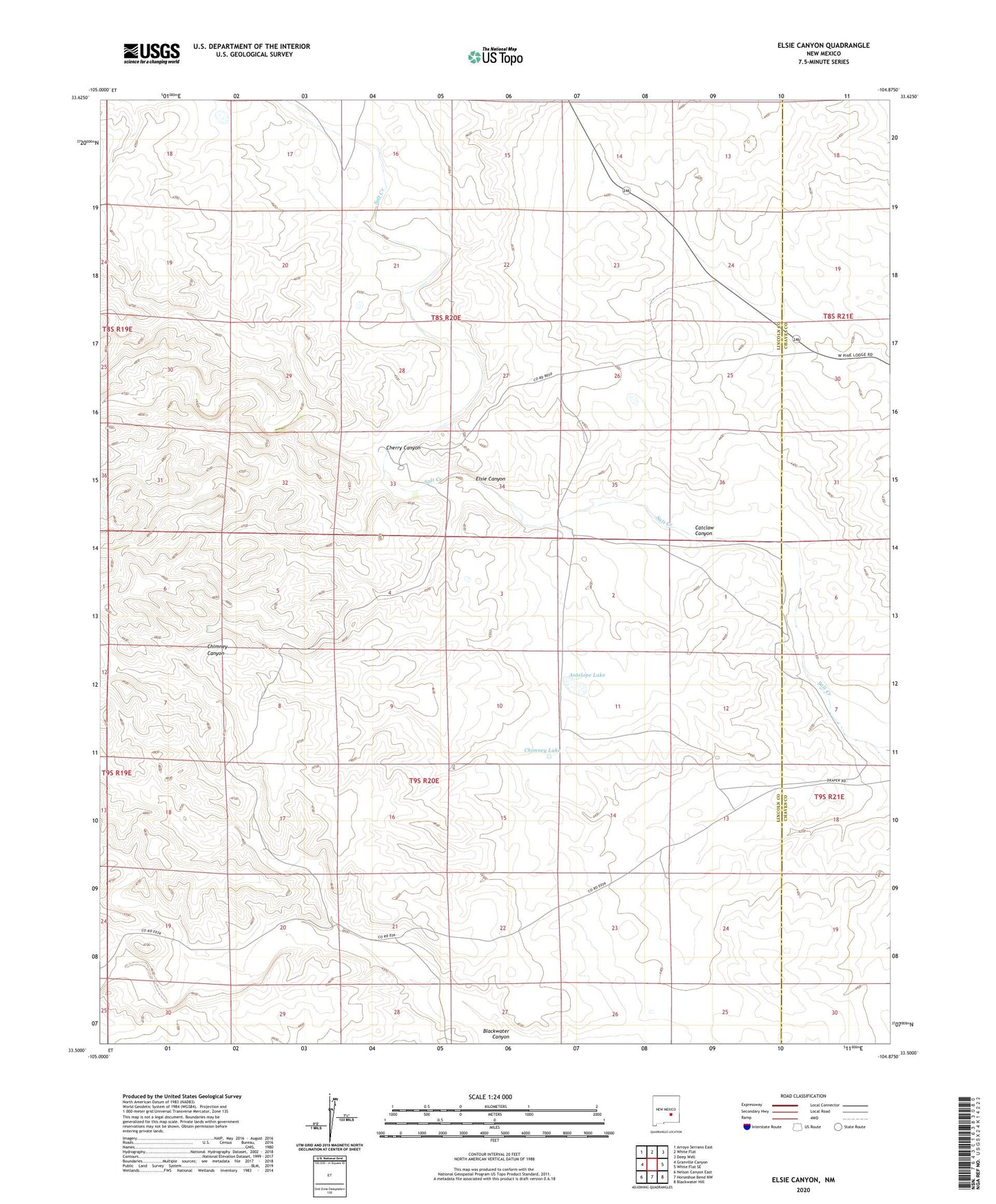
2023 topographic map quadrangle Elsie Canyon in the state of New Mexico. Scale: 1:24000. Based on the newly updated USGS 7.5' US Topo map series, this map is in the following counties: Lincoln, Chaves. The map contains contour data, water features, and other items you are used to seeing on USGS maps, but also has updated roads and other features. This is the next generation of topographic maps. Printed on high-quality waterproof paper with UV fade-resistant inks.
Quads adjacent to this one:
West: Granville Canyon
Northwest: Arroyo Serrano East
North: White Flat
Northeast: Deep Well
East: White Flat SE
Southeast: Blackwater Hill
South: Horseshoe Bend NW
Southwest: Nelson Canyon East
This map covers the same area as the classic USGS quad with code o33104e8.
Contains the following named places: Antelope Lake, Buck Pasture Well, Catclaw Canyon, Cherry Canyon, Chimney Lake, Elsie Canyon, Porter Ranch, Salt Creek Ranch, Sand Windmill, South Well