MyTopo
White Flat New Mexico US Topo Map
Couldn't load pickup availability
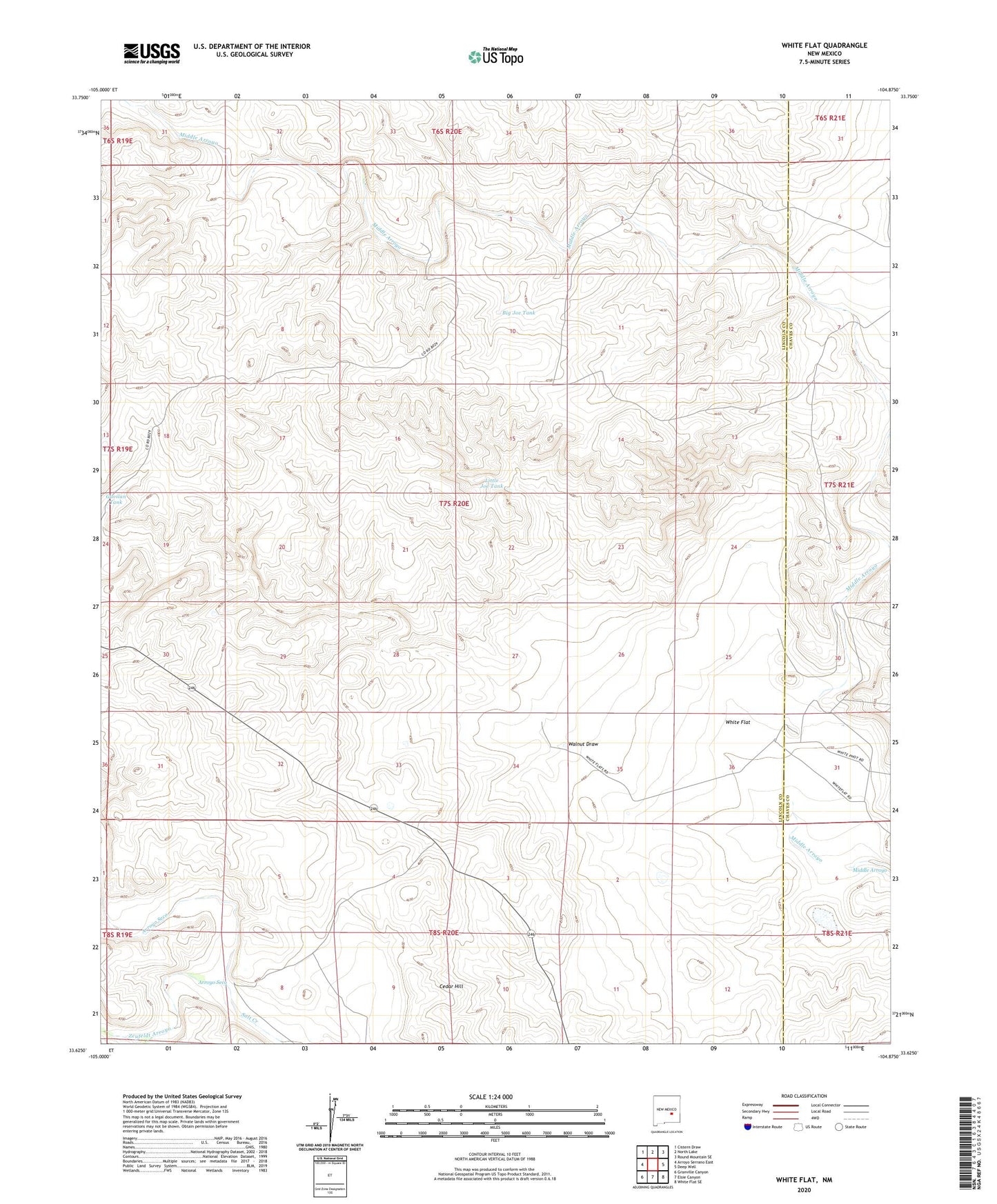
2023 topographic map quadrangle White Flat in the state of New Mexico. Scale: 1:24000. Based on the newly updated USGS 7.5' US Topo map series, this map is in the following counties: Lincoln, Chaves. The map contains contour data, water features, and other items you are used to seeing on USGS maps, but also has updated roads and other features. This is the next generation of topographic maps. Printed on high-quality waterproof paper with UV fade-resistant inks.
Quads adjacent to this one:
West: Arroyo Serrano East
Northwest: Cistern Draw
North: North Lake
Northeast: Round Mountain SE
East: Deep Well
Southeast: White Flat SE
South: Elsie Canyon
Southwest: Granville Canyon
This map covers the same area as the classic USGS quad with code o33104f8.
Contains the following named places: Arroyo Seco, Big Joe Tank, Browns Lake Well, Cedar Hill, Cedar Hill Ranch, East Well, Gavilan Tank, High Lonesome Water Tank, Little Joe Tank, Middle Arroyo East Well, Middle Arroyo Ranch, Middle Arroyo West Well, Miller Well Number 1, Walnut Draw, West Well, White Flat, White Flat Ranch, Zeufeldt Arroyo