MyTopo
White Peak New Mexico US Topo Map
Couldn't load pickup availability
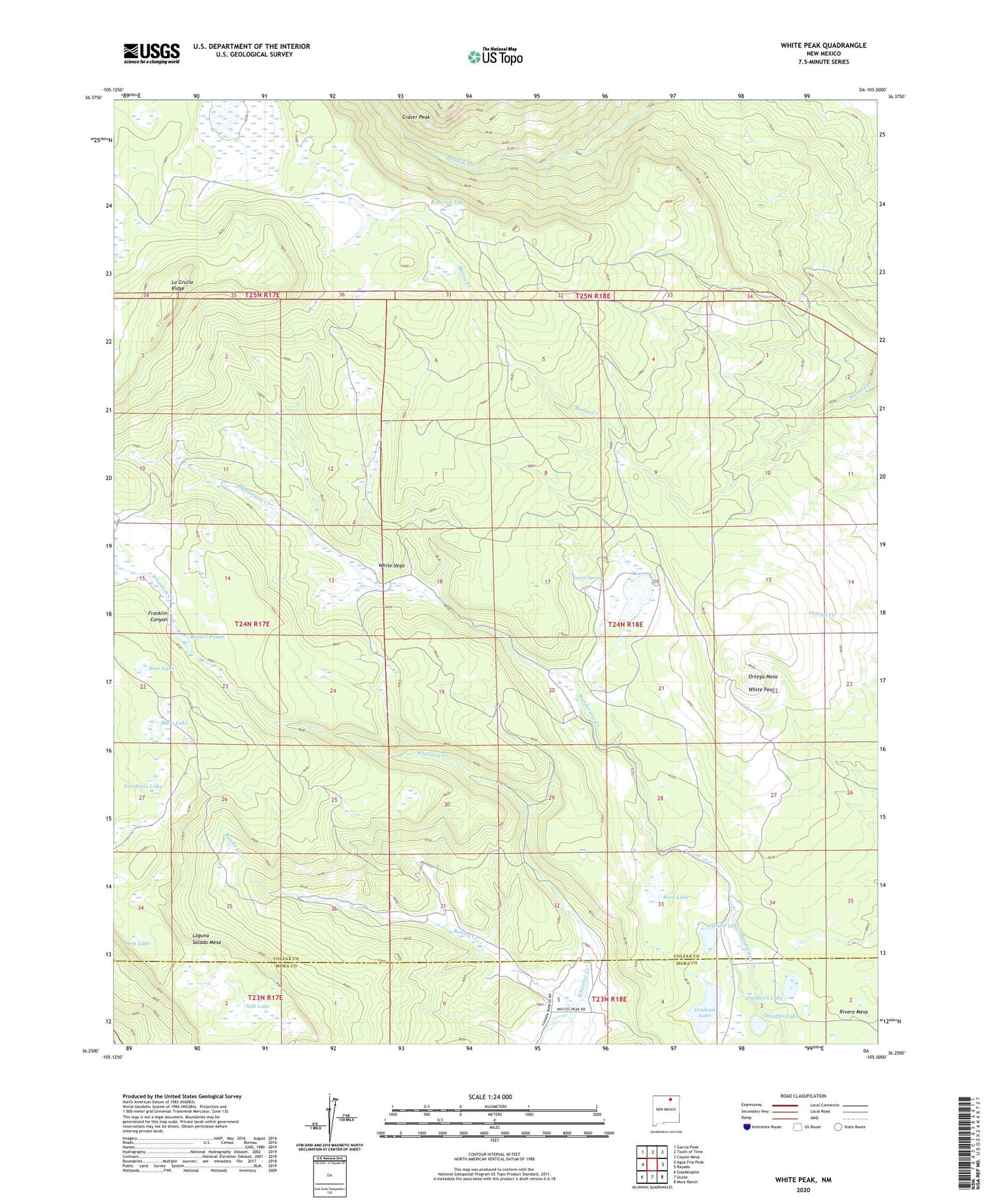
2020 topographic map quadrangle White Peak in the state of New Mexico. Scale: 1:24000. Based on the newly updated USGS 7.5' US Topo map series, this map is in the following counties: Colfax, Mora. The map contains contour data, water features, and other items you are used to seeing on USGS maps, but also has updated roads and other features. This is the next generation of topographic maps. Printed on high-quality waterproof paper with UV fade-resistant inks.
Quads adjacent to this one:
West: Agua Fria Peak
Northwest: Garcia Peak
North: Tooth of Time
Northeast: Coyote Mesa
East: Rayado
Southeast: Mora Ranch
South: Ocate
Southwest: Guadalupita
Contains the following named places: Bear Lake, Beaver Ponds, Bonita Creek, C S Cattle Company, Caldwell Lake, Crater Peak, Deep Lake, Duran Meadow, Gardenia Lake, Graham Lake, La Grulla Cow Camp, La Grulla Lake, La Grulla Ridge, Lucero Spring, Mare Lake, Martinez Cow Camp, Ortega Mesa, Rimrock Lake, Rivera Mesa, Rose Lake, Salt Lake, Sawmill Camp, Sawmill Lake, Sheaffer Lake, Waldoguara, White Peak, White Vega