MyTopo
Guadalupita New Mexico US Topo Map
Couldn't load pickup availability
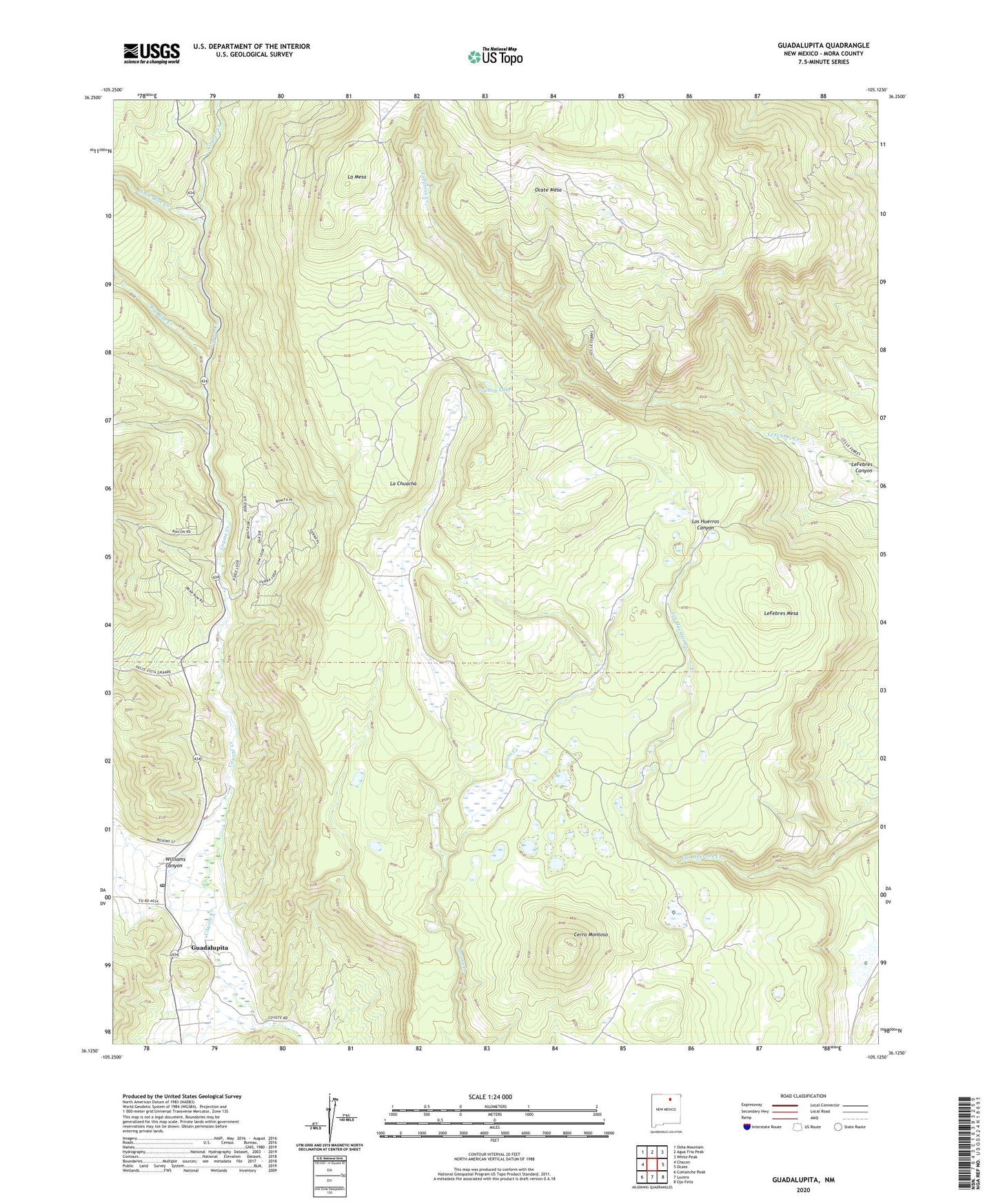
2023 topographic map quadrangle Guadalupita in the state of New Mexico. Scale: 1:24000. Based on the newly updated USGS 7.5' US Topo map series, this map is in the following counties: Mora. The map contains contour data, water features, and other items you are used to seeing on USGS maps, but also has updated roads and other features. This is the next generation of topographic maps. Printed on high-quality waterproof paper with UV fade-resistant inks.
Quads adjacent to this one:
West: Chacon
Northwest: Osha Mountain
North: Agua Fria Peak
Northeast: White Peak
East: Ocate
Southeast: Ojo Feliz
South: Lucero
Southwest: Comanche Peak
This map covers the same area as the classic USGS quad with code o36105b2.
Contains the following named places: Big Blue Creek, Blatteman, Cerro Montoso, Cowboy Lake, Coyote Creek State Park, Guadalupita, Guadalupita Post Office, Hughs, John Hays Mine, La Chuacha, La Mesa, LeFebres Mesa, Little Blue Creek, Ocate Mesa, Williams Canyon