MyTopo
Mora Ranch New Mexico US Topo Map
Couldn't load pickup availability
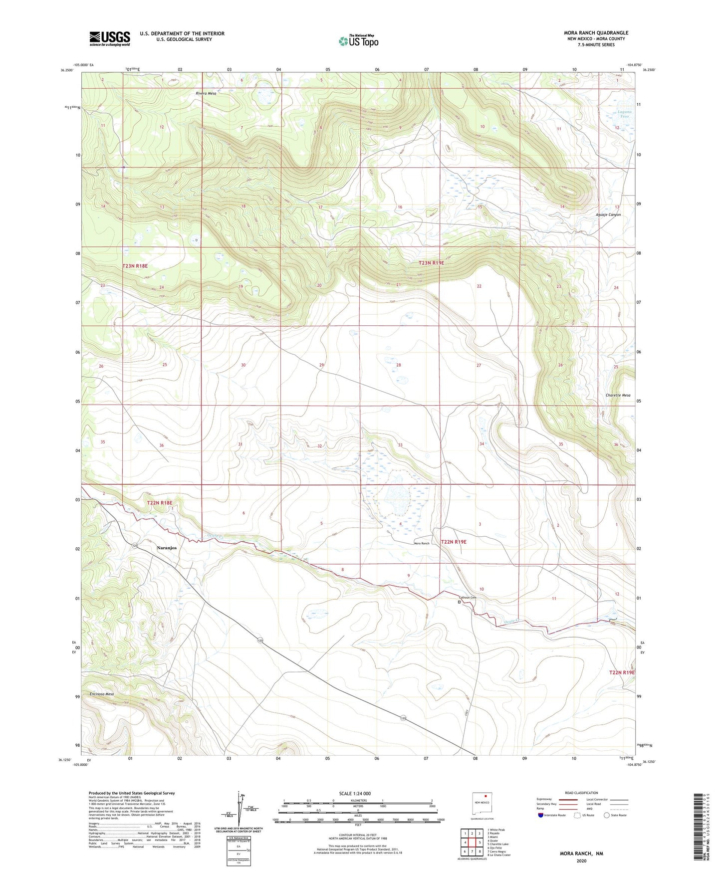
2023 topographic map quadrangle Mora Ranch in the state of New Mexico. Scale: 1:24000. Based on the newly updated USGS 7.5' US Topo map series, this map is in the following counties: Mora. The map contains contour data, water features, and other items you are used to seeing on USGS maps, but also has updated roads and other features. This is the next generation of topographic maps. Printed on high-quality waterproof paper with UV fade-resistant inks.
Quads adjacent to this one:
West: Ocate
Northwest: White Peak
North: Rayado
Northeast: Miami
East: Charette Lake
Southeast: La Chata Crater
South: Cerro Negro
Southwest: Ojo Feliz
This map covers the same area as the classic USGS quad with code o36104b8.
Contains the following named places: Aguaje Canyon, Baca, Calhoun Cemetery, Encinosa Mesa, Laguna Yeso, Mora Ranch, Mora Ranch Airport, Naranjos, Naranjos Post Office