MyTopo
Yates New Mexico US Topo Map
Couldn't load pickup availability
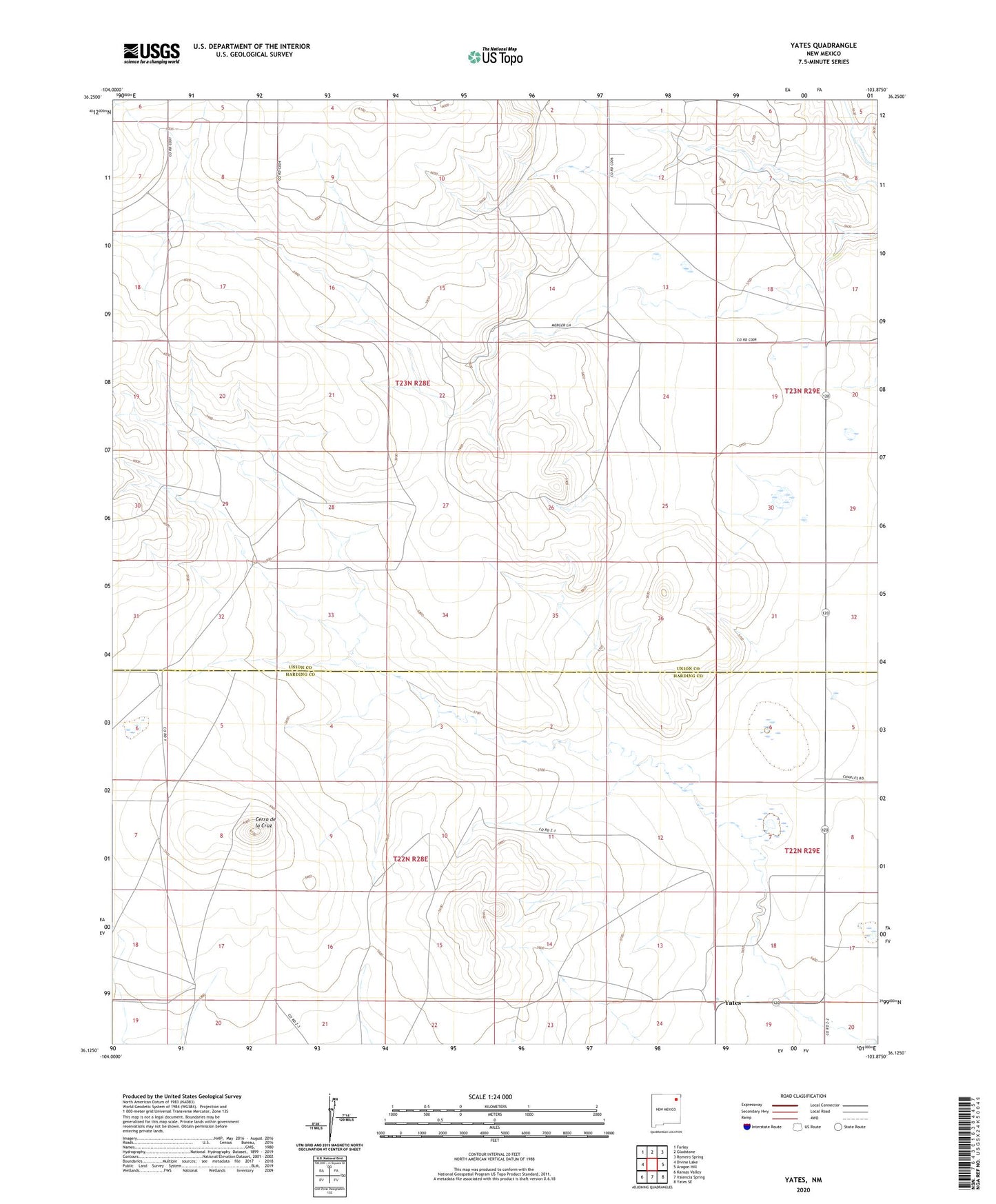
2023 topographic map quadrangle Yates in the state of New Mexico. Scale: 1:24000. Based on the newly updated USGS 7.5' US Topo map series, this map is in the following counties: Union, Harding. The map contains contour data, water features, and other items you are used to seeing on USGS maps, but also has updated roads and other features. This is the next generation of topographic maps. Printed on high-quality waterproof paper with UV fade-resistant inks.
Quads adjacent to this one:
West: Divine Lake
Northwest: Farley
North: Gladstone
Northeast: Romero Spring
East: Aragon Hill
Southeast: Yates SE
South: Valencia Spring
Southwest: Kansas Valley
This map covers the same area as the classic USGS quad with code o36103b8.
Contains the following named places: Cerro de la Cruz, Island Lake, Martinez, Yates, Yates Post Office, Yates Weather Station