MyTopo
Divine Lake New Mexico US Topo Map
Couldn't load pickup availability
Also explore the Divine Lake Forest Service Topo of this same quad for updated USFS data
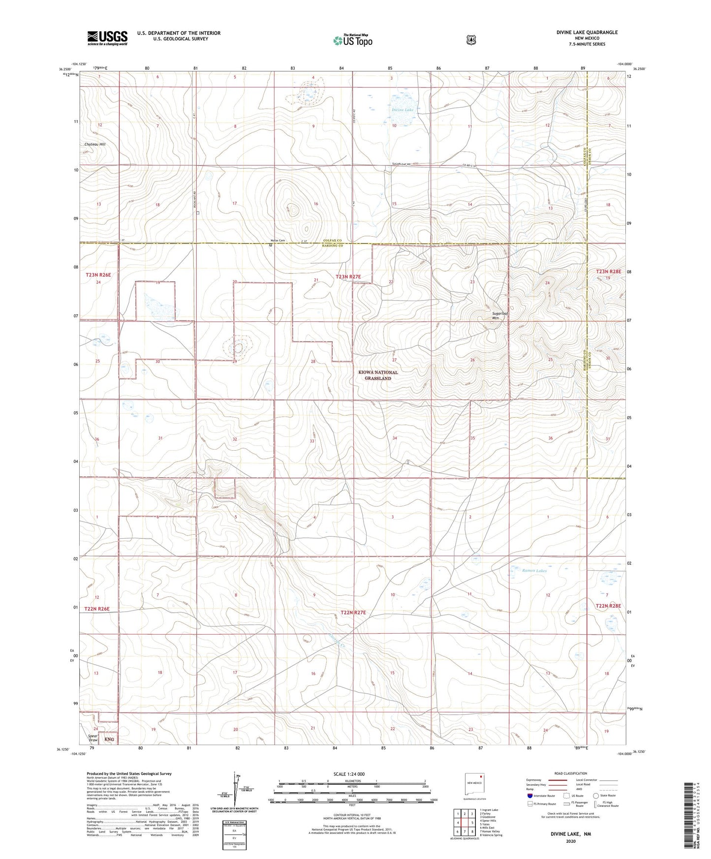
2023 topographic map quadrangle Divine Lake in the state of New Mexico. Scale: 1:24000. Based on the newly updated USGS 7.5' US Topo map series, this map is in the following counties: Harding, Colfax, Union. The map contains contour data, water features, and other items you are used to seeing on USGS maps, but also has updated roads and other features. This is the next generation of topographic maps. Printed on high-quality waterproof paper with UV fade-resistant inks.
Quads adjacent to this one:
West: Spear Hills
Northwest: Ingram Lake
North: Farley
Northeast: Gladstone
East: Yates
Southeast: Valencia Spring
South: Kansas Valley
Southwest: Mills East
This map covers the same area as the classic USGS quad with code o36104b1.
Contains the following named places: Burkes, Burks Well, Divine Lake, Gaines Well, Mofax Cemetery, Ramon Lakes, Ramon Well, Reddick Well, Rock Lake, Rock Well, Sanders East Well, Shaw Well, Sugarloaf Mountain, Sugarloaf Ranch