MyTopo
Youngs Lake New Mexico US Topo Map
Couldn't load pickup availability
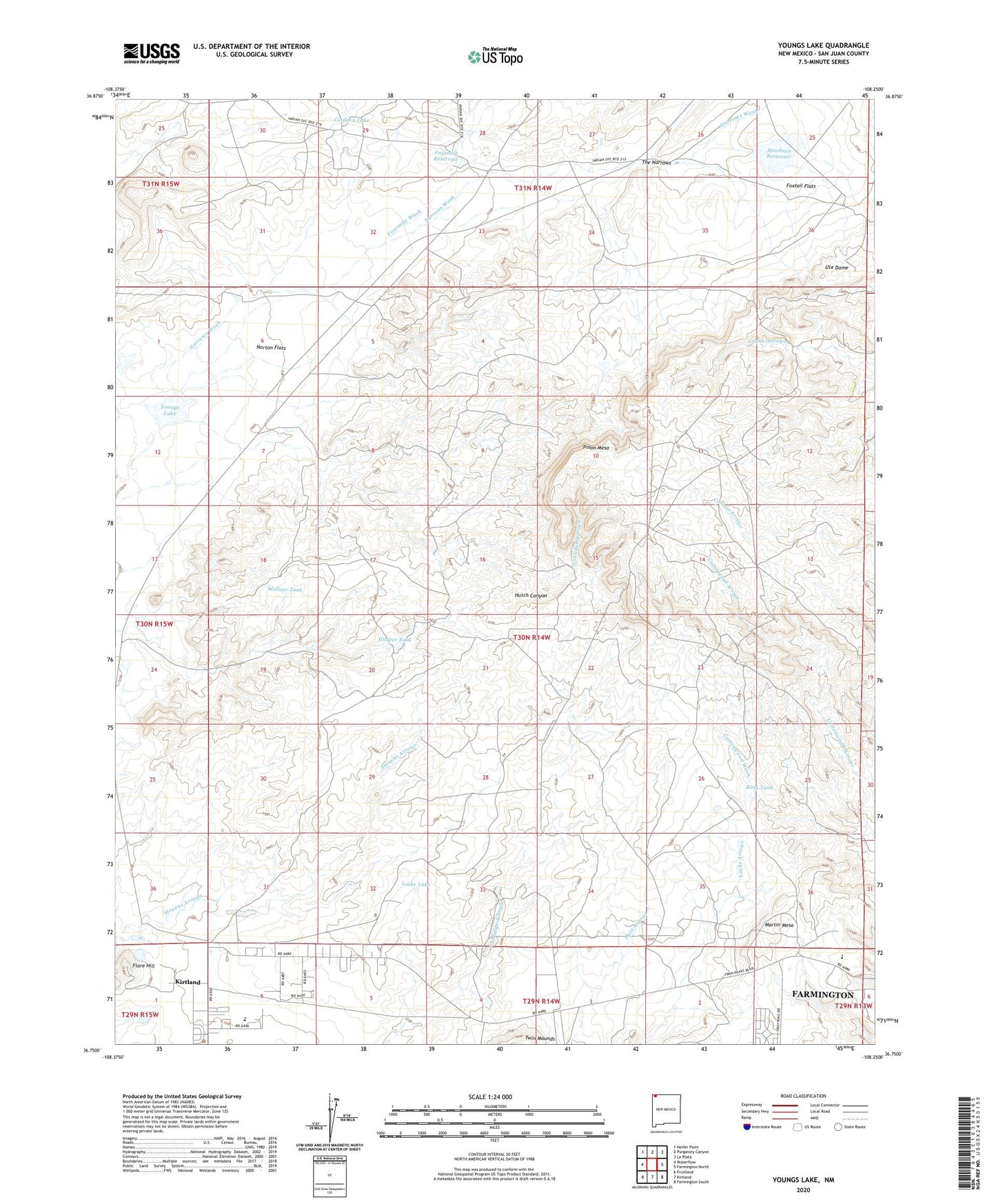
2020 topographic map quadrangle Youngs Lake in the state of New Mexico. Scale: 1:24000. Based on the newly updated USGS 7.5' US Topo map series, this map is in the following counties: San Juan. The map contains contour data, water features, and other items you are used to seeing on USGS maps, but also has updated roads and other features. This is the next generation of topographic maps. Printed on high-quality waterproof paper with UV fade-resistant inks.
Quads adjacent to this one:
West: Waterflow
Northwest: Heifer Point
North: Purgatory Canyon
Northeast: La Plata
East: Farmington North
Southeast: Farmington South
South: Kirtland
Southwest: Fruitland
Contains the following named places: A-14 Water Well, A-16 Water Well, Cline Well, Cordova Lake, Cottonwood Wash, Farmington Division, Flare Hill, Fourmile Reservoir, Fourmile Wash, Foxtail Flats, GT-1 Water Well, GT-2 Water Well, Harper Tank, Harper Windmill, King Tank, Locke Lake, Macu Racetrack, Martin Mesa, McCabe Dam, Meadows Reservoir, Norton Flats, Pinon Mesa, SJ-13-2 Water Well, SJ-24-4 Water Well, The Narrows, Ute Dome, Wallace Ranch, Wallace Tank, West Fork Fourmile Wash, Youngs Lake