
MyTopo
Akron New York US Topo Map
Couldn't load pickup availability
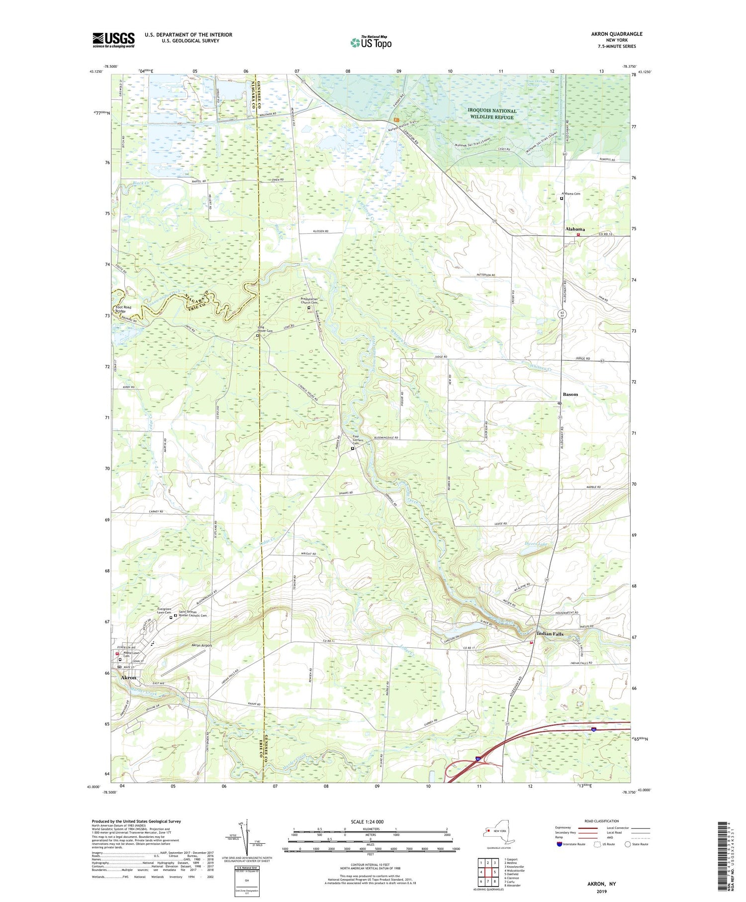
2019 topographic map quadrangle Akron in the state of New York. Scale: 1:24000. Based on the newly updated USGS 7.5' US Topo map series, this map is in the following counties: Genesee, Erie, Niagara. The map contains contour data, water features, and other items you are used to seeing on USGS maps, but also has updated roads and other features. This is the next generation of topographic maps. Printed on high-quality waterproof paper with UV fade-resistant inks.
Quads adjacent to this one:
West: Wolcottsville
Northwest: Gasport
North: Medina
Northeast: Knowlesville
East: Oakfield
Southeast: Alexander
South: Corfu
Southwest: Clarence
Contains the following named places: Akron, Akron Airport, Akron Free Methodist Church, Akron High School, Akron Middle School, Akron Mobile Home Park, Akron Post Office, Akron Primary School, Akron Volunteer Fire Company Station 2, Alabama, Alabama Cemetery, Alabama Volunteer Fire Department Station 2, Antones's Mobile Home Park, Basom, Basom Post Office, Common School Number 1, Dande Farms Country Club, Delre's Greenhouse, Divers Lake, Evergreen Lawn Cemetery, Foot Road Bridge, Four Corners Cemetery, Gaskosada, Indian Falls, Indian Falls Cemetery, Indian Falls Fire Department, Indian Falls Methodist Church, Long House Cemetery, Maple Lawn Cemetery, Pembroke Station, Pembroke Toll Plaza, Presbyterian Church Cemetery, Saint John's Evangelical Lutheran Church, Saint Teresas Roman Catholic Cemetery, School Number 1, School Number 2, School Number 3, School Number 7, School Number 8, Tonawanda Indian Community Center, Tonawanda Reservation, Town of Alabama, Village of Akron, White Memorial State Game Farm, Whitney Creek, ZIP Code: 14013


