MyTopo
Knowlesville New York US Topo Map
Couldn't load pickup availability
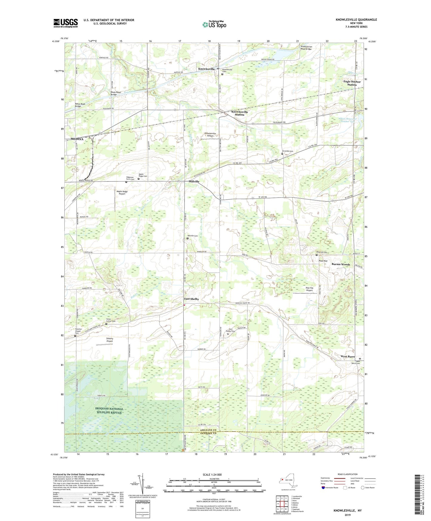
2023 topographic map quadrangle Knowlesville in the state of New York. Scale: 1:24000. Based on the newly updated USGS 7.5' US Topo map series, this map is in the following counties: Orleans, Genesee. The map contains contour data, water features, and other items you are used to seeing on USGS maps, but also has updated roads and other features. This is the next generation of topographic maps. Printed on high-quality waterproof paper with UV fade-resistant inks.
Quads adjacent to this one:
West: Medina
Northwest: Lyndonville
North: Ashwood
Northeast: Kent
East: Albion
Southeast: Batavia North
South: Oakfield
Southwest: Akron
This map covers the same area as the classic USGS quad with code o43078b3.
Contains the following named places: Albion Reservoir Number Two, Bates Road Bridge, Beals Road Bridge, Bethel Baptist Church, Boyce Farms, Burma Woods, Christian Cemetery, Eagle Harbor Station, East Shelby, East Shelby Cemetery, East Shelby Volunteer Fire Company, Faith Covenant Fellowship, Fletcher Chapel Cemetery, H and R Farms, Hageman Farm Cemetery, Hugh Lane Farm, Knowlesville, Knowlesville Airport, Knowlesville Cemetery, Knowlesville Post Office, Knowlesville Station, Knowlesville United Methodist Church, Maple Ridge Airport, Maple Ridge Cemetery, Meadowbrook Farms, Medina Business Park, Medina Reservoir, Mill Stream Farms, Millville, Millville Cemetery, Millville Methodist Church, Orchard Manor Residential Health Care Facility, Pettit Farms, Pine Hill, Pine Hill Airport, Pine Hill Cemetery, Presbyterian Road Bridge, School Number 12, School Number 15, School Number 3, School Number 5, School Number 6, School Number 7, School Number 8, School Number 9, Sunrich Farms, Swart Culver Cemetery, Toussaint Farms, West Barre, West Barre Cemetery, West Barre United Methodist Church, Wild Rose Farm, Willows Adult Home, Zelazny Airport, ZIP Code: 14479